
Hide
St Luke, Goostrey, Church of England
hide
Hide
Hide
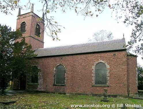
St Luke,
Church Bank,
Goostrey
Hide
It was founded in 1561.
Church History
An ancient chapelry in Sandbach: St. Mary parish, which in 1724 became the district church for the townships of Blackden, Goostrey cum Barnshaw, and Twemlow.
Church Records
C = Christenings (Baptisms) ; M = Marriages ; B = Burials ; BTs = Bishop's Transcripts
| Original Registers | C 1561-1964 ; M 1561-1840 ; B 1561-1949 — Cheshire Archives (P 124) C from 1965 ; M from 1837 ; B from 1949 — Church |
| Microfilm Copies | C 1561-1964 ; M 1561-1840 ; B 1561-1949 — Cheshire Archives ; Manchester Archives & Local Studies ; Family History Society of Cheshire ; Sandbach Library |
| Bishop's Transcripts | 1576, 1596, 1600, 1607, 1611, 1618, 1620, 1622-23, 1626, 1628-29, 1634-35, 1637(?), 1658-1666, 1668-76, 1679-81, 1683-85, 1690-91, 1694-96,1699-1706, 1708, 1711-12, 1714-15, 1717-67, 1770-1860 (microfilmed) — Cheshire Archives |
| Copies and Indexes | C 1561-1937 ; MB 1561-1900 (typescript by Rev. C. H. Huggill) — Church ; Cheshire Archives ; Family History Society of Cheshire ; Holmes Chapel Library ; Sandbach Library M 1754-1837 — North & East Cheshire Marriage Index - may be viewable at subscription sites such as ancestry or findmypast M 1837-1950 — Cheshire BMD (CC:1041) |
| Notes | CB 1607-09 ; M 1605-09 — omitted from registers |
It is located at SJ7797470043 (Lat/Lon 53.226964, -2.331386). You can see this on maps provided by:
- OpenStreetMap
- Google Maps
- StreetMap (Current Ordnance Survey maps)
- Bing (was Multimap)
- Old Maps Online
- National Library of Scotland (Old Ordnance Survey maps)
- Vision of Britain (Click "Historical units & statistics" for administrative areas.)
- English Jurisdictions in 1851 (Unfortunately the LDS have removed the facility to enable us to specify a starting location, you will need to search yourself on their map.)
- Magic (Geographic information) (Click + on map if it doesn't show)
- GeoHack (Links to on-line maps and location specific services.)