
Hide
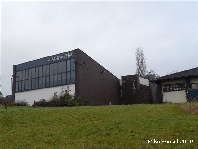
St Barnabas, Hattersley, Church of England
hide
Hide
Hide
St Barnabas,
Hattersley Road East,
Hattersley
Hide
It was founded in 1963.
Hattersley Road East.
Church History
Founded in 1963 as a chapel to Mottram In Longdendale: St. Michael, and on 9 June 1966 it became the district church for the village of Hattersley (previously served by Mottram In Longdendale: St. Michael and Godley cum Newton Green: St. John the Baptist).
Church Records
C = Christenings (Baptisms) ; M = Marriages ; B = Burials ; BTs = Bishop's Transcripts
| Original Registers | C 1963-2007 ; M 1966-1984 — CRO (P 328) C from 2007 ; M from 1984 — Church |
| Copies and Indexes | M 1966-1984 — Cheshire BMD (TA:CE26) |
It is located at SJ9827294901 (Lat/Lon 53.450866, -2.027493). You can see this on maps provided by:
- OpenStreetMap
- Google Maps
- StreetMap (Current Ordnance Survey maps)
- Bing (was Multimap)
- Old Maps Online
- National Library of Scotland (Old Ordnance Survey maps)
- Vision of Britain (Click "Historical units & statistics" for administrative areas.)
- English Jurisdictions in 1851 (Unfortunately the LDS have removed the facility to enable us to specify a starting location, you will need to search yourself on their map.)
- Magic (Geographic information) (Click + on map if it doesn't show)
- GeoHack (Links to on-line maps and location specific services.)