
Hide
St Cross, Knutsford, Church of England
hide
Hide
Hide
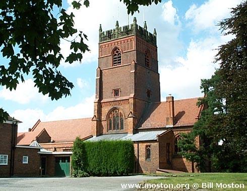
St Cross,
Mobberley Road,
Knutsford
Hide
Also known as: Cross Town: St. Cross.
Cross Street.
Church History
From 1860 the district church for the township of Knutsford Over, and part of the township of Knutsford Nether (previously served by Knutsford: St. John the Baptist). The boundaries of "The District Chapelry of Saint Cross, Cross Town" were described in the London Gazette on 30 August 1860:
"All that part of the parish of Knutsford, in the county and diocese of Chester, wherein the present incumbent of such parish now possesses the exclusive cure of souls, which is comprised within the township of Knutsford Over. And also all that part of the township of Knutsford Nether, in the same parish wherein such incumbent now possesses the exclusive cure of souls, which is situate to the east and north of an imaginary line commencing on the boundary between the said parish of Knutsford and the parish of Rostherne, at a point opposite to the middle of the northern end of the fence which divides the inclosure numbered 382 on the Tithe Commutation Map of the said township of Knutsford Nether, and on the map hereunto annexed from the enclosure numbered 381 on the same maps, and extending thence in a direction generally southward to and along the middle of such fence and of the fences which divide the enclosure numbered 382 as aforesaid, and the enclosures numbered respectively 282 and 343 on the said maps from the enclosures numbered respectively 379, 378, 377, 376, 375, 374, 373, and 364 on the same maps, to the middle of the fence dividing the inclosure numbered 343 as aforesaid from the inclosure numbered 344 on the same maps, and extending thence westward along the middle of such last mentioned fence as far as a point, opposite to the middle of the fence which divides the inclosure numbered, 342 on the last named maps from the inclosure numbered 344 as aforesaid, and extending thence southward along the middle of such last mentioned fence to the middle of the high road leading from Knutsford Nether to Macclesfielcl, and extending thence south-eastward along the middle of the last mentioned road as far as the boundary dividing the said township of Knutsford Nether from the township of Knutsford Over aforesaid."
Church Records
C = Christenings (Baptisms) ; M = Marriages ; B = Burials ; BTs = Bishop's Transcripts
| Original Registers | C 1858-1980 ; M 1861-1997 ; B 1858-1968 — Cheshire Archives (P 189) C from 1980 ; M from 1997 — Church |
| Microfilm Copies | C 1858-1980 ; M 1861-1948 ; B 1858-1968 — Cheshire Archives |
| Bishop's Transcripts | 1858-1885 (microfilmed) — Cheshire Archives |
| Copies and Indexes | M 1861-1997 — Cheshire BMD (CE:1048) B 1858-1995 — published by North Cheshire Family History Society |
| Monumental Inscriptions | Published by North Cheshire Family History Society, 1975 |
- OpenStreetMap
- Google Maps
- StreetMap (Current Ordnance Survey maps)
- Bing (was Multimap)
- Old Maps Online
- National Library of Scotland (Old Ordnance Survey maps)
- Vision of Britain (Click "Historical units & statistics" for administrative areas.)
- English Jurisdictions in 1851 (Unfortunately the LDS have removed the facility to enable us to specify a starting location, you will need to search yourself on their map.)
- Magic (Geographic information) (Click + on map if it doesn't show)
- GeoHack (Links to on-line maps and location specific services.)