
Hide
St Paul, Hooton, Church of England
hide
Hide
Hide
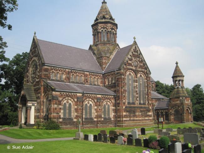
St Paul,
Hooton Parish Church, Chester Road,
Little Sutton
Hide
It was founded in 1858.
Founded in 1862 as the district church for the townships of Childer Thornton, Hooton and Little Sutton (previously served by Eastham: St. Mary). The boundaries of "The District Chapelry of Saint Paul, Hooton" were described in the London Gazette on 10 June 1862::
"All those portions of the parish of Eastham, in the county of Chester, and in the diocese of Chester, wherein the present incumbent of such parish now possesses the exclusive cure of souls which a re comprised within and are co-extensive with the several townships of Little Sutton, of Childer Thornton, and of Hooton."
C = Christenings (Baptisms) ; M = Marriages ; B = Burials ; BTs = Bishop's Transcripts
| Original Registers | C 1862-1946 ; M 1863-1968 — Cheshire Archives (P 306) C from 1946 ; M from 1968 ; B from 1926 — Church |
| Microfilm Copies | C 1862-1934 ; M 1863-1954 — Cheshire Archives |
| Bishop's Transcripts | 1892-93, 1897-1901 (microfilmed) — Cheshire Archives |
| Copies and Indexes | M 1863-1958 — Cheshire BMD (CW:CE32) |
| Monumental Inscriptions | Published by the Family History Society of Cheshire (Wirral Group), 1985 |
- OpenStreetMap
- Google Maps
- StreetMap (Current Ordnance Survey maps)
- Bing (was Multimap)
- Old Maps Online
- National Library of Scotland (Old Ordnance Survey maps)
- Vision of Britain (Click "Historical units & statistics" for administrative areas.)
- English Jurisdictions in 1851 (Unfortunately the LDS have removed the facility to enable us to specify a starting location, you will need to search yourself on their map.)
- Magic (Geographic information) (Click + on map if it doesn't show)
- GeoHack (Links to on-line maps and location specific services.)