
Hide
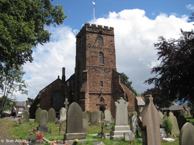
St Mary and St Helen, Neston, Church of England
hide
Hide
Hide
St Mary and St Helen,
High Street,
Neston
Hide
It was founded in 1559.
High Street.
Church History
An ancient parish church, originally serving the townships of Great Neston, Ledsham, Leighton, Little Neston, Ness, Raby, Thornton Hough and Willaston. It included the chapel of Little Neston: St. Michael.
The district was affected by the following boundary changes:
- 1859 — reduced when the township of Ledsham was transferred to Capenhurst: Holy Trinity.
- 1865 May 19 — reduced when the township of Willaston and parts of the townships of Little Neston and Raby were transferred to Willaston: Christ Church.
Church Records
C = Christenings (Baptisms) ; M = Marriages ; B = Burials ; BTs = Bishop's Transcripts
| Original Registers | C 1559-1965 ; M 1559-1974 ; B 1559-1918 — Cheshire Archives (P 149) C from 1965 ; M from 1974 ; B from 1918 — Church |
| Microfilm Copies | C 1559-1952 ; M 1559-1951 ; B 1559-1918 — Cheshire Archives C 1559-1901 ; M 1559-1911 ; B 1559-1918 — Family History Society of Cheshire ; Birkenhead Central Library C 1559-1901 ; M 1559-1911 ; B 1559-1888 — Neston Library |
| Bishop's Transcripts | 1581 ; 1587, 1593, 1603(?), 1605, 1607,1609-10, 1612, 1617-24, 1626-27, 1630, 1632, 1634, 1636, 1638-39, 1641-42, 1666-70, 1672-77, 1679-85,1694-95, 1700-39, 1741-45, 1747-1840, 1871-74 (microfilmled) — Cheshire Archives |
| Copies and Indexes | CMB 1561-1671 (transcript) — Chester Library CMB 1561-1871 — Cheshire Parish Register Project M 1700-1765, 1800-1837 (incomplete) — Bertram Merrell Marriage Index of Cheshire (1750-1836) M 1837-1958 — Cheshire BMD (CW:CE37) B 1574-1871 — National Burial Index |
| Monumental Inscriptions | Transcript by B. H. Chorley, 1970 — Cheshire Archives |
It is located at SJ2911777452 (Lat/Lon 53.289271, -3.064781). You can see this on maps provided by:
- OpenStreetMap
- Google Maps
- StreetMap (Current Ordnance Survey maps)
- Bing (was Multimap)
- Old Maps Online
- National Library of Scotland (Old Ordnance Survey maps)
- Vision of Britain (Click "Historical units & statistics" for administrative areas.)
- English Jurisdictions in 1851 (Unfortunately the LDS have removed the facility to enable us to specify a starting location, you will need to search yourself on their map.)
- Magic (Geographic information) (Click + on map if it doesn't show)
- GeoHack (Links to on-line maps and location specific services.)