
Hide
Chapel Road, Mount Pleasant, Odd Rode, Methodist (United Free)
hide
Hide
Hide
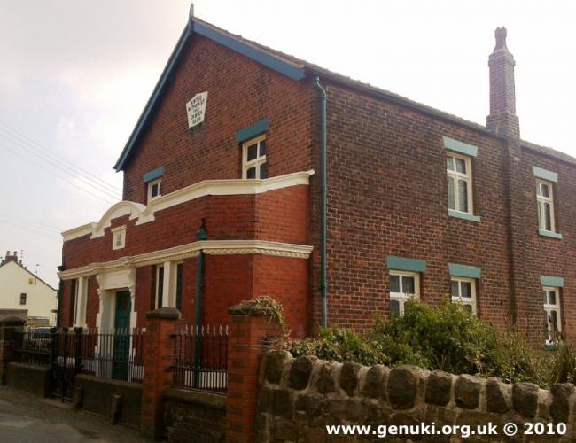
Methodist (United Free) church,
Chapel Road, Mount Pleasant,
Odd Rode
Chapel Road, Mount Pleasant,
Odd Rode
Hide
It is located at SJ8491856640 (Lat/Lon 53.106737, -2.226735). You can see this on maps provided by:
- OpenStreetMap
- Google Maps
- StreetMap (Current Ordnance Survey maps)
- Bing (was Multimap)
- Old Maps Online
- National Library of Scotland (Old Ordnance Survey maps)
- Vision of Britain (Click "Historical units & statistics" for administrative areas.)
- English Jurisdictions in 1851 (Unfortunately the LDS have removed the facility to enable us to specify a starting location, you will need to search yourself on their map.)
- Magic (Geographic information) (Click + on map if it doesn't show)
- GeoHack (Links to on-line maps and location specific services.)