
Hide
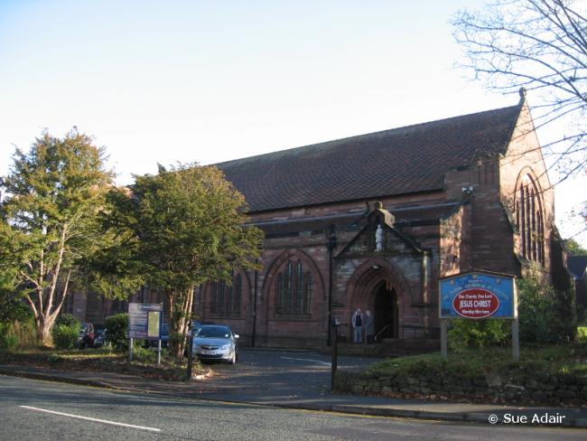
St Stephen, Prenton, Church of England
hide
Hide
Hide
St Stephen,
Prenton Lane/Reservoir Road,
Prenton
Hide
It was founded in 1894.
Prenton Lane/Reservoir Road.
Church History
Founded in 1894 as a chapel to Woodchurch: Holy Cross. In 1902 it became a district church for parts of the township of Prenton, Oxton and Tranmere (previously served by Woodchurch: Holy Cross, Tranmere: St. Paul, Tranmere: St. Catherine and Oxton: St. Saviour . The boundaries of "The Consolidated Chapelry of Saint Stephen, Prenton" were described in the London Gazette on 7 March 1902:
"All those several contiguous portions of the parish of Woodchurch, of the new parish (sometime district chapelry) of Saint Paul Tranmere, of the new parish (sometime district chapelry) of Saint Catherine Tranmere, and of the new parish (sometime particular district) of Saint Saviour Oxton, all in the county of Chester and in the diocese of Chester which are comprised within and are bounded by an imaginary line commencing at a point in the middle of the western end of Temple-road at its junction with Moss-lane upon the boundary which divides the said new parish of Saint Catherine Tranmere from the new parish of Saint Saviour Oxton aforesaid and extending thence first southward and then westward along the said boundary (thereby following in the first-named direction the eastern side of Moss-lane) to a point in the middle of Storetonroad and extending thence north-westward along the middle of the las!-named road for a distance of one and a half chains or thereabouts to its intersection by Woodchurch-road and extending thence westward along the middle of the lastnamed road for a distance of nine chains or thereabouts to a point where it meets the boundary which divides the said new parish of Saint Saviour Oxton from the paiish of Woodchurch aforesaid and extending thence westward along the last-mentioned boundary (thereby generally fol owing the northern side of the last-mentioned road) for a distance of sixteen chains or thereabouts to a point on the southern side of Euston Cottage opposite to the northern end of the footpath or roadway connecting the said lastnamed road with Prenton-lane and extending thence southward to and along the middle of the said footpath or roadway for a distance of thirtyeight and a half chains or thereabouts (thereby crossing the said Woodchurch-road and Waterpark-road) to its junction with Prenton-lane aforesaid and extending thence south-westward along the middle of the last-named lane for a distance of fourteen chains or thereabouts to its junction with the road and footpath leading from the Wirral Water Works Pumping Station through Preiiton Village to Little Storeton and extending thence south-eastward along the middle of the last described road and footpath for a distance of twenty-four chains or thereabouts to a point upon the boundary which divides the said parish of Woodchurch from the parish of Bebington and extending thence first south-eastward and then north-eastward along the last described boundary for a distance of sixty-one chains or thereabouts to the point in the middle of Storeton-road where it meets the boundary which divides the said parish of Bebington from the new parish of Saint Paul Tranmere aforesaid and extending thence southeastward along the last described boundary (thereby following the middle of the last-named road) for a distance of two chains or thereabouts to the point where it meets the boundary which divides the said new paiish of Saint Paul Tranmere from the new parish of Christ Church Higher Bebington in the county and diocese aforesaid and extending thence eastward along the last described boundary for a distance of twenty and a half chains or thereabouts to the point where it crosses the middle of Borough-road and extending thence north-westward along the middle of the last-named road for a distance of fifty-eight and two-thirds chains or thereabouts (thereby crossing at its junction with Pienton-road We.st the boundary which divides the said new parish of Saiut Paul Tranmere from the new parish of Saint Catherine Tranmere aforesaid) to the point opposite to the middle of the footpath leading to Temple-road aforesaid and extending thence westward to and along the middle of the last described footpath for a distance of nine chains or thereabouts to the point where it joins Temple-road aforesaid and extending thence westward along the middle of the last-named road for a distance of thirteen and a half chains or thereabouts to its western end at the first described point at its junction with Moss-Jane aforesaid upon the boundary which divides the said new parish of Saint Catherine Tranmere from the new parish of Saint Saviour Oxton aforesaid at which point the said imaginary line commenced."
The district was affected by the following boundary changes:
- 1948 February 27 — enlarged when the following area was transferred from Woodchurch: Holy Cross: "All that portion of the said parish of Woodchurch bounded upon the north by the said parish of Saint Saviour, Oxton, upon the east by the said parish of Saint Stephen, Prenton, upon the south by the parish of Bebington and upon the remaining side, that is to say upon the west by an imaginary line commencing at a point in the centre of the Wrexham and Bidston branch of the Bntish Railways (Eastern Region) on the boundary which divides the said parish of Bebington from the said parish of Woodchurch and extending thence north westwards along the middle of the said branch railway to its junction with the boundary which divides the said pansh of Woodchurch from the said parish of Saint Saviour, Oxton"
- 1948 February 27 — enlarged to include the following area transfererd from Oxton: St. Saviour: "All that portion of the said parish of Saint Saviour, Oxton, bounded upon the south east, the south and the west by the said parish of Saint Stephen, Prenton, and upon the remaining side, that is to say, upon the north west by an imaginary line commencing on the boundary which divides the said parish of Saint Stephen, Prenton, from the said parish of Saint Saviour, Oxton, at a point in the middle of Woodchurch Road where that road is crossed by Storeton Road and extending thence north eastwards along the middle of'Woodchurch Road to the boundary which divides the said parish of Saint Saviour, Oxton, from the said parish of Saint Stephen, Prenton."
The district included the chapel of Prenton: St. Alban.
Church Records
C = Christenings (Baptisms) ; M = Marriages ; B = Burials ; BTs = Bishop's Transcripts
| Original Registers | C 1894-1954 ; M 1902-1957 — Cheshire Archives (P 55) C from 1954 ; M from 1957 — Church |
| Copies and Indexes | M 1902-1951 — Cheshire BMD (WR:BK20) |
- OpenStreetMap
- Google Maps
- StreetMap (Current Ordnance Survey maps)
- Bing (was Multimap)
- Old Maps Online
- National Library of Scotland (Old Ordnance Survey maps)
- Vision of Britain (Click "Historical units & statistics" for administrative areas.)
- English Jurisdictions in 1851 (Unfortunately the LDS have removed the facility to enable us to specify a starting location, you will need to search yourself on their map.)
- Magic (Geographic information) (Click + on map if it doesn't show)
- GeoHack (Links to on-line maps and location specific services.)