
Hide
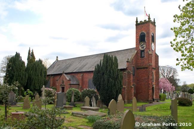
Christ Church, Woodford, Church of England
hide
Hide
Hide
Christ Church,
Old Hall Lane/Chester Road,
Woodford
Hide
It was founded in 1841.
Church History
Founded in 1842 as a chapel to Prestbury: St. Peter. In 1873 it became the district church for the township of Woodford (previously served by Prestbury: St. Peter). The boundaries of "The District Chapelry of Christ Church, Woodford" were described in the London Gazette on 17 January 1873:
"All that part of the said parish of Prestbury which is comprised within, and is co-extensive with, the limits of the said township of Woodford"
Church Records
C = Christenings (Baptisms) ; M = Marriages ; B = Burials ; BTs = Bishop's Transcripts
| Original Registers | C 1842-1926 ; M 1874-1935 ; B 1848-1922 — Cheshire Archives (P 148) C from 1926 ; M from 1935 ; B from 1941 — Church |
| Microfilm Copies | C 1842-1926 ; M 1874-1935 ; B 1848-1922 — Cheshire Archives ; Stockport Heritage Library |
| Bishop's Transcripts | 1842, 1844-46, 1848, 1850, 1852, 1854-66, 1891-92 (microfilmed) — Cheshire Archives ; Family History Society of Cheshire |
| Copies and Indexes | M 1874-1992 — Cheshire BMD (ST:ST78) |
| Monumental Inscriptions | Published by North Cheshire Family History Society (edited by A. Clarke), 1993 |
It is located at SJ8853882308 (Lat/Lon 53.337548, -2.173591). You can see this on maps provided by:
- OpenStreetMap
- Google Maps
- StreetMap (Current Ordnance Survey maps)
- Bing (was Multimap)
- Old Maps Online
- National Library of Scotland (Old Ordnance Survey maps)
- Vision of Britain (Click "Historical units & statistics" for administrative areas.)
- English Jurisdictions in 1851 (Unfortunately the LDS have removed the facility to enable us to specify a starting location, you will need to search yourself on their map.)
- Magic (Geographic information) (Click + on map if it doesn't show)
- GeoHack (Links to on-line maps and location specific services.)