
Hide
Brushford
hide
Hide
hide
- Almanacs◬
- Archives & Libraries◬
- Bibliography◬
- Biography◬
- Business & Commerce Records◬
- Cemeteries◬
- Census
- Chronology◬
- Church History
- Church Records
- Churches
- Civil Registration◬
- Correctional Institutions◬
- Court Records◬
- Description & Travel
- Directories◬
- Emigration & Immigration◬
- Encyclopaedias & Dictionaries◬
- Folklore◬
- Gazetteers
- Genealogy◬
- Handwriting◬
- Heraldry◬
- Historical Geography◬
Hide
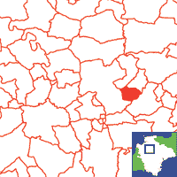
Click on map to view parish boundaries in detail.
Hide
Hide
hide
- History
- Jewish History◬
- Land & Property◬
- Language & Languages◬
- Manors◬
- Maps
- Medical Records◬
- Merchant Marine◬
- Military History◬
- Names, Geographical◬
- Names, Personal◬
- Newspapers◬
- Occupations◬
- Periodicals◬
- Politics & Government◬
- Poor Houses, Poor Law◬
- Population◬
- Probate Records◬
- Schools◬
- Social Life & Customs◬
- Societies◬
- Taxation◬
- Voting Registers◬
Hide
"BRUSHFORD, a small parish in the Taw valley, 5 miles S. by W. of Chulmleigh, has only 144 souls, and about 1000 acres of land, nearly all the property, and in the occupation of the Luxton family, to whom it has belonged since the reign of Elizabeth, previous to which the manor and tithes belonged to Hartland Abbey. The Church (St. Mary,) is a small structure, with a tower and three bells. George Luxton, Esq., is impropiator of the tithes and patron of the perpetual curacy, valued at £51, and now held by the Rev. John Luxton, B.A." [From White's Devonshire Directory (1850)]
A Parish in North Tawton Hundred, the Archdeaconry of Barnstaple and the the Diocese of Exeter.
Hide
Snetzler, M.F. North Devon Surname Index to the Census. Microfiche: M.F. Snetzler. [Covers 1881 census records for this parish]
Brushford - from J. Stabb. Some Old Devon Churches (London: 1908-16).
The registers (christenings 1695-1812, marriages 1697-1838, and burials 1694-1812) are at the Devon Record Office.
The Devon FHS publishes indexes covering (as of June 2004): Marriages 1754-1837 - for details see their Devon Parish List.
Nothing entered into the IGI (as of Jan 1993).
Chanter, J.F. Irregular Marriages at Brushford. Devon & Cornwall Notes & Queries 10 (1918-19) pp.285-286.
An index of baptisms, marriages and burials in the parishes of Bondleigh, Bow, Brushford, Burrington, Chawleigh, Chulmleigh, Clannaborough, Coleridge, Eggesford, Lapford, North Tawton, Nymet Rowland, Wembworthy and Zeal Monachorum. With photographs of the churches and extracts from White's Directory (1850). CD-ROM 063, Exeter, Devon FHS (2014). [Bondleigh Bapt: 1813-1839, Mar: 1754-1837, Bur: 1813-1838; Bow Bapt: 1813-1839, Mar: 1754-1837, Bur: 1813-1837; Brushford Bapt: 1813-1839, Mar: 1756-1837, Bur: 1813-1837; Burrington Bapt: 1813-1839, Mar: 1754-1837, Bur: 1813-1837; Chawleigh Bapt: 1813-1839, Mar: 1754-1837, Bur: 1813-1837; Chulmleigh Bapt: 1813-1839, Mar: 1754-1837, Bur: 1813-1837; Clannaborough Bapt: 1813-1840, Mar: 1759-1834, Bur: 1697-1836; Coleridge Bapt: 1813-1840, Mar: 1754-1837, Bur: 1813-1837; Eggesford Bapt: 1813-1840, Mar: 1754-1837, Bur: 1750-1838; Lapford Bapt: 1813-1839, Mar: 1567-1837, Bur: 1813-1837; North Tawton Bapt: 1813-1839, Mar: 1754-1837, Bur: 1813-1837; Nymet Rowland Bapt: 1813-1841, Mar: 1756-1836, Bur: 1734-1879; Wembworthy Bapt: 1813-1839, Mar: 1733-1837, Bur: 1813-1839; Zeal Monachorum Bapt: 1813-1840, Mar: 1754-1837, Bur: 1813-1837]
Section on Brushford from Samuel Lewis: A Topographical Dictionary of England (1831), provided by Mel Lockie.
The transcription of the section for this parish from the National Gazetteer (1868), provided by Colin Hinson.
- Ask for a calculation of the distance from Brushford to another place.
Oliver, Mrs. Brice. Notes on Brushford. Trans. Devon Assoc. 89 (1957) pp. 153- 159.
Williams, H. Fulford. Notes on the Parish of Brushford, Devon. Typescript (1949) 6 leaves. [Westcountry Studies Library]
View a map of the boundaries of this town/parish.
You can see maps centred on OS grid reference SS676076 (Lat/Lon: 50.852719, -3.882291), Brushford which are provided by:
- OpenStreetMap
- Google Maps
- StreetMap (Current Ordnance Survey maps)
- Bing (was Multimap)
- Old Maps Online
- National Library of Scotland (Old Ordnance Survey maps)
- Vision of Britain (Click "Historical units & statistics" for administrative areas.)
- English Jurisdictions in 1851 (Unfortunately the LDS have removed the facility to enable us to specify a starting location, you will need to search yourself on their map.)
- Magic (Geographic information) (Click + on map if it doesn't show)
- GeoHack (Links to on-line maps and location specific services.)
- All places within the same township/parish shown on an Openstreetmap map.
- Nearby townships/parishes shown on an Openstreetmap map.
- Nearby places shown on an Openstreetmap map.