Hide
Accrington
hide
Hide
hide
Hide
hide
Hide
Hide
"ACCRINGTON, a town, two townships, two chapelries, and a subdistrict, in Whalley parish, Lancashire. The town adjoins the E Lancashire railway, near the Leeds and Liverpool canal, 4 miles by road and 5¼ by railway E of Blackburn. It is large and thriving; has sprung up within the present century; is a seat of petty sessions and county courts; publishes a weekly newspaper; carries on industry in twenty cotton factories, three print works, extensive turkey-red dye-work, several large chemical works, foundries, steel-works, and a brewery; is well supplied with water from reservoirs; and has a head post office, a r. station with telegraph, a banking office, four hotels, a market house of 1868, public rooms of 1857 in the Italian style at a cost of £8,000, a mechanics' institution, a museum and pleasure gardens, a church enlarged in 1826, a church of 1841 in the early English style at a cost of £8,000, a church of 1866, two fine Wesleyan chapels of 1845 and 1866, nine other dissenting chapels, a Roman Catholic chapel, seven public schools, and two annual fairs. Pop. in 1851, 7,481; in 1861, 13,872. Houses, 2,579. The townships are New A. and Old A. Acres, 2,480 and 740. Real property, £52,634; of which £8,409 are in mines. Pop., 11,853 and 5,835.The chapelries are St. James and Christchurch; and both are p. curacies in the diocese of Manchester. Value of each, £300.* Patrons of St. J., Hulme's Trustees; of C., Trustees. The subdistrict is conterminate with the two townships."
John Marius Wilson, Imperial Gazetteer of England and Wales (1870-72)
Hide
Local Studies Unit,
Central Library,
St. James St,
Accrington Lancs.
BB5 1NQ
Tel: 01254 872385
Fax: 01254 301066
Monumental inscriptions and the burial register of the Machpelah Baptist church have been published by the LFH&HS.
Details about the census records, and indexes for Accrington.
The surviving records for the parish church of St James commence in 1766. An index of marriages 1813-1837 has been published by the LFH&HS.
The Register Office covering the Accrington area is Hyndburn and Rossendale.
The National Gazetteer of Great Britain and Ireland - 1868
"ACCRINGTON, a chapelry, post-town, and considerable village in the parish of Whalley, and hundred of Blackburn, in the county palatine of Lancaster, 4 miles N.W. of Haslingden. It includes the two townships of Old and New Accrington, and has become within the last few years a place of some consequence. The population has increased at a very rapid rate. It is situated on the river Henburn, near the Leeds and Liverpool canal, and is a station on the East Lancashire railway. Its importance is derived from its position in the centre of the calico-printing trade. Several large cotton-mills and print-works have been established, which afford abundant occupation to the working classes. Many hands are employed in the coal-mines and quarries. The living of Old Accrington is a perpetual curacy in the diocese of Manchester, value £300, in the patronage of Hulme's Trustees. The church was taken down and rebuilt in 1826. The living of Christ Church is a curacy, in the patronage of trustees. There is a national school which was erected in 1806."
- Ask for a calculation of the distance from Accrington to another place.
In 1835 Accrington was a chapelry and township in the parish of Whalley.

View maps of Accrington and places within its boundaries.
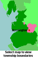
View a map of the boundaries of this town/parish.
You can see maps centred on OS grid reference SD769276 (Lat/Lon: 53.744644, -2.351546), Accrington which are provided by:
- OpenStreetMap
- Google Maps
- StreetMap (Current Ordnance Survey maps)
- Bing (was Multimap)
- Old Maps Online
- National Library of Scotland (Old Ordnance Survey maps)
- Vision of Britain (Click "Historical units & statistics" for administrative areas.)
- English Jurisdictions in 1851 (Unfortunately the LDS have removed the facility to enable us to specify a starting location, you will need to search yourself on their map.)
- Magic (Geographic information) (Click + on map if it doesn't show)
- GeoHack (Links to on-line maps and location specific services.)
- All places within the same township/parish shown on an Openstreetmap map.
- Nearby townships/parishes shown on an Openstreetmap map.
- Nearby places shown on an Openstreetmap map.
Andrew Jackson provides information about the Accrington Pals and the losses that they suffered at the battle of the Somme.
For probate purposes prior to 1858, Accrington was in the Archdeaconry of Chester, in the Diocese of Chester. The original Lancashire wills for the Archdeaconry of Chester are held at the Lancashire Record Office.
You can also see Family History Societies covering the nearby area, plotted on a map. This facility is being developed, and is awaiting societies to enter information about the places they cover.
