
Hide
Atherton
hide
Hide
hide
Hide
hide
Hide
Hide
ATHERTON, a town, a township, a chapelry, and a subdistrict, in the parish and district of Leigh, Lancashire. The town stands about a mile E of the Bolton and Kenyon railway, 2 miles NNE of Leigh, and 13 WNW of Manchester. It bears also the name of Chowbent; and it has a station of the name of Atherton on the railway, and a post office of the name of Chowbent under Manchester. The inhabitants are employed variously in cotton factories, iron works, nail factories, and collieries. Pop., 2,692. Houses, 683. The township includes also part of the town of Leigh, and is partly rural. Acres, 2,323. Real property, £23,638; of which £8,920 are in mines. Pop., 5,907. Houses, 1,222. Atherton Hall stands near the site of a quondam seat of the Athertons; and is the property of Lord Lilford. The chapelry is a p. curacy in the diocese of Manchester. Value, £100. Patron, Lord Lilford. The church was rebuilt in 1810. There are Baptist and Unitarian chapels, and a national school. The subdistrict includes Tyldesley-cum-Shakerley. Pop., 11,936.
John Marius Wilson, Imperial Gazetteer of England and Wales (1870-72)
Hide
Local studies information is held at Wigan library.
| Bolton Old Rd Unitarian, Chowbent |
Details about the census records, and indexes for Atherton.
| Bolton Old Rd Unitarian, Chowbent |
The Register Office covering the Atherton area is Wigan & Leigh.
The National Gazetteer of Great Britain and Ireland - 1868
"ATHERTON, a chapelry in the parish of Leigh and hundred of West Derby, in the county palatine of Lancaster, 2 miles to the N. of Leigh. It is a station on the Bolton and Kenyon Junction railway, a branch of the London and North Western. The Manchester and Wigan canal passes within a little distance of the chapelry The inhabitants are employed in the cotton manufactories, the collieries, and ironworks. Nail-making and machine-making are also carried on. The living is a perpetual curacy in the diocese of Manchester, of the value of £100, in the patronage of Lord Lilford. The chapel is dedicated to St. John the Baptist. Atherton Hall, the seat of Lord Lilford, is a modern mansion, near the site of an old hall which was the seat of the Athertons. Fairs are held here on the 29th June and the 29th August."
"CHEWBENT, a village in the county of Lancashire, 2 miles N. of Leigh. It is situated near the Bolton railway."
- Ask for a calculation of the distance from Atherton to another place.
In 1835 Atherton was a township in the parish of Leigh.
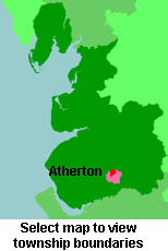
View maps of Atherton and places within its boundaries.
View a map of the boundaries of this town/parish.
You can see maps centred on OS grid reference SD671024 (Lat/Lon: 53.517183, -2.49719), Atherton which are provided by:
- OpenStreetMap
- Google Maps
- StreetMap (Current Ordnance Survey maps)
- Bing (was Multimap)
- Old Maps Online
- National Library of Scotland (Old Ordnance Survey maps)
- Vision of Britain (Click "Historical units & statistics" for administrative areas.)
- English Jurisdictions in 1851 (Unfortunately the LDS have removed the facility to enable us to specify a starting location, you will need to search yourself on their map.)
- Magic (Geographic information) (Click + on map if it doesn't show)
- GeoHack (Links to on-line maps and location specific services.)
- All places within the same township/parish shown on an Openstreetmap map.
- Nearby townships/parishes shown on an Openstreetmap map.
- Nearby places shown on an Openstreetmap map.
For probate purposes prior to 1858, Atherton was in the Archdeaconry of Chester, in the Diocese of Chester. The original Lancashire wills for the Archdeaconry of Chester are held at the Lancashire Record Office.
You can also see Family History Societies covering the nearby area, plotted on a map. This facility is being developed, and is awaiting societies to enter information about the places they cover.