
Hide
Blackburn
hide
Hide
hide
Hide
hide
Hide
Hide
BLACKBURN, a town, a township, a parish, a subdistrict, a district, and a hundred in Lancashire. The town stands on the river Blackwater, 9 miles E by S of Preston, and 12½ N by W of Bolton. The Leeds and Liverpool canal passes through it; and railways go from it N, S, E, and W. The country around it possesses little scenic interest, yet is sheltered by hills on the NE and NW; and it lay for ages wild and barren, but has been much improved by cultivation. The town is large; was very prosperous up to the juncture of the cotton distress in 1862; and has owed most of its importance to modern manufactures. Cottonmills and print works are numerous, and employ a large proportion of the inhabitants. The value of cotton goods produced prior to 1862 exceeded £2,000,000 a year. The cotton-spinning was much advanced by an invention of James Hargrave, a native, originally a carpenter; and the cotton-printing was introduced by the family of Sir Robert Peel. Some woollen cloth also is made; considerable industry is carried on in breweries, foundries, and machine-works, particularly in the manufacture of weaving-machinery; and much business is done in connexion with neighbouring factories, corn mills, paper-mills, and collieries. Weekly markets are held on Wednesday and Saturday; and fairs on the Wednesday before 2 Feb., on every alternate Wednesday thence till Michaelmas, and on Easter Monday, 11 and 12 May, 29 Sept., and 17 Oct. The town has a head post office, a telegraph station, four banking offices, and three chief inns; and publishes four weekly newspapers. It is a seat of courts. and a polling-place; it was constituted, by the act of 1832, a parliamentary borough sending two members to parliament; and it was made municipal in 1851, with government by a mayor, twelve aldermen, and thirty-six councillors. Acres, 3,610. Real property, in 1860, £170,703. Direct taxes, in 1857, £26,354. Electors in 1868, 1,894. Pop. in 1841, 36,629; in 1861, 63,126. Houses, 11,306.
John Marius Wilson, Imperial Gazetteer of England and Wales (1870-72) more ...
Hide
Blackburn Central Library,
Town Hall Street,
Blackburn
BB2 1AH
| St John the Evangelist Church of England, Blackburn |
| St Mary (Cathedral), Blackburn, Church of England |
| St Paul Church of England, Blackburn |
| St Peter, Blackburn, Church of England |
| Chapel St Independent, Blackburn |
| Whalley New Road Cemetery, Blackburn |
| Clayton St Wesleyan Methodist, Blackburn |
| Paradise Lane United Methodist Free Church, Blackburn |
| St Alban, Blackburn, Roman Catholic |
| Paradise Lane Society of Friends, Blackburn |
Details about the census records, and indexes for Blackburn.
The following items have been produced by the LFH&HS.
- A marriage index for St Mary the Virgin, 1813-1837.
- A birth/baptism register index is available for Islington Particular Baptists 1772-1837.
- A birth/baptism register index for Chapel Street Congregational, Oct 1777 - Aug 1837.
- St John - Grave Occ list 1781-1950.
- Islington Particular Baptists burials, Sept 1764 - June 1837.
- Monumental Inscriptions, Non-Conformist chapels.
The Register Office covering the Blackburn area is Blackburn.
"WENSLEY-FOLD, a township in the parish of Blackburn, county Lancaster, 2 miles N. of Blackburn. It is bounded on the S. by the river Derwent."
- Ask for a calculation of the distance from Blackburn to another place.
In 1835 the parish of Blackburn contained the townships of Blackburn, Walton le Dale, Cuerdale, Samlesbury, Balderstone, Osbaldeston, Clayton-le-Dale, Salesbury, Dinckley, Billington, Mellor, Ramsgreave, Wilpshire, Pleasington, Livesey, Tockholes, Lower Darwen, Over Darwen, Little Harwood, Great Harwood, Rishton, Witton, Yate with Pickup Bank and Eccleshill.
The following Facebook groups discuss the past and contain old pictures:
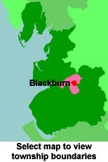
View maps of Blackburn and places within its boundaries.
View a map of the boundaries of this town/parish.
You can see maps centred on OS grid reference SD682285 (Lat/Lon: 53.751675, -2.483516), Blackburn which are provided by:
- OpenStreetMap
- Google Maps
- StreetMap (Current Ordnance Survey maps)
- Bing (was Multimap)
- Old Maps Online
- National Library of Scotland (Old Ordnance Survey maps)
- Vision of Britain (Click "Historical units & statistics" for administrative areas.)
- English Jurisdictions in 1851 (Unfortunately the LDS have removed the facility to enable us to specify a starting location, you will need to search yourself on their map.)
- Magic (Geographic information) (Click + on map if it doesn't show)
- GeoHack (Links to on-line maps and location specific services.)
- All places within the same township/parish shown on an Openstreetmap map.
- Nearby townships/parishes shown on an Openstreetmap map.
- Nearby places shown on an Openstreetmap map.
The Workhouse site has an interesting description of Blackburn workhouse.
For probate purposes prior to 1858, Blackburn was in the Archdeaconry of Chester, in the Diocese of Chester. The original Lancashire wills for the Archdeaconry of Chester are held at the Lancashire Record Office.
You can also see Family History Societies covering the nearby area, plotted on a map. This facility is being developed, and is awaiting societies to enter information about the places they cover.