
Hide
Bold
hide
Hide
hide
Hide
hide
Hide
Hide
"BOLD, two hamlets and a township in Prescot parish, Lancashire. The hamlets are Bold and Bold-Heath; and the former stands adjacent to the Runcorn railway, 4 miles ESE of Prescot. The township includes also the hamlet of Maypole. Acres, 4,338. Real property, £8,151. Pop., 798. Houses, 137. The family of Bold, now represented by that of Bold Hoghton, were seated here from the Conquest till 1761; and they give name to Bold-street in Liverpool. The ancient mansion is now a farmhouse; and the modern one is Bold Hall. Bishop Barnes, who died in 1588, was a native."
John Marius Wilson, Imperial Gazetteer of England and Wales (1870-72)
Hide
Local studies information is held at St.Helens library.
Details about the census records, and indexes for Bold.
| Clockface Road, Bold, Wesleyan Methodist |
The Register Office covering the Bold area is St Helens.
The National Gazetteer of Great Britain and Ireland - 1868
"BOLD, a township in the parish of Prescot, hundred of West Derby, in the county palatine of Lancaster, 3 miles to the S. of St. Helen's. The St. Helen's and Lancashire and Yorkshire railway runs through it. The township contains Bold Heath, and the hamlet of Maypole. It has some charitable endowments, which produce about £13 per annum. The family of the Bolds had their seat here from before the Norman Conquest down to the year 1761, when the male line became extinct. The curious old hall still exists as a farmhouse, on the demesne attached to the present mansion of Bold Hall, the seat of Sir H. B. Hoghton, Bart. Richard Barnes, Bishop of Carlisle, and afterwards of Durham, in the latter half of the 16th century, was born here."
"MAYPOLE, a hamlet in the township of Bold, parish of Prescot, county Lancaster, 3 miles, E. of Prescot, and 5 S.E. of St. Helen's. It is situated near Bold Heath, and on the line of the Runcorn railway."
- Ask for a calculation of the distance from Bold to another place.
In 1835 Bold was a township in the parish of Prescot.
View maps of Bold and places within its boundaries.
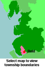
View a map of the boundaries of this town/parish.
You can see maps centred on OS grid reference SJ536907 (Lat/Lon: 53.411092, -2.699552), Bold which are provided by:
- OpenStreetMap
- Google Maps
- StreetMap (Current Ordnance Survey maps)
- Bing (was Multimap)
- Old Maps Online
- National Library of Scotland (Old Ordnance Survey maps)
- Vision of Britain (Click "Historical units & statistics" for administrative areas.)
- English Jurisdictions in 1851 (Unfortunately the LDS have removed the facility to enable us to specify a starting location, you will need to search yourself on their map.)
- Magic (Geographic information) (Click + on map if it doesn't show)
- GeoHack (Links to on-line maps and location specific services.)
- All places within the same township/parish shown on an Openstreetmap map.
- Nearby townships/parishes shown on an Openstreetmap map.
- Nearby places shown on an Openstreetmap map.
For probate purposes prior to 1858, Bold was in the Archdeaconry of Chester, in the Diocese of Chester. The original Lancashire wills for the Archdeaconry of Chester are held at the Lancashire Record Office.
You can also see Family History Societies covering the nearby area, plotted on a map. This facility is being developed, and is awaiting societies to enter information about the places they cover.