
Hide
Broughton East
hide
Hide
There are other places also called Broughton in Lancashire.
Hide
hide
Hide
hide
Hide
Hide
BROUGHTON (East), or Broughton-Field, a township-chapelry in Cartmel parish, Lancashire; 4 miles N of Cartmel r. station, and 7 NE of Ulverstone. Post Town, Cartmel, under Newton-in-Cartmel. Acres, 2,830. Real property, £4,332. Pop., 534. Houses, 107. The property is subdivided. Broughton Grove, Broughton Hall, and Broughton Lodge are chief residences. The living is a p. curacy in the diocese of Carlisle. Value, £67.* Patron, the Duke of Devonshire. The church is good.
John Marius Wilson, Imperial Gazetteer of England and Wales (1870-72)
Hide
Local studies information is held at Cumbria Record Office & Local Studies Library, Barrow and at Kendal library.
Details about the census records, and indexes for Broughton East.
| St Paul Church of England, Grange over Sands |
| St Peter Church of England, Field Broughton |
| The Fell Church, Grange over Sands, Church of England |
| Kents Bank Rd Congregational, Grange over Sands |
| Grange Bank Rd Cemetery, Grange over Sands |
| St Charles Roman Catholic, Grange over Sands |
The Register Office covering the Broughton East area is Ulverston.
The National Gazetteer of Great Britain and Ireland - 1868
"BROUGHTON EAST , (or Field Broughton) a chapelry in the parish of Cartmel, hundred of Lonsdale North of the Sands, in the county palatine of Lancaster, 2 miles to the N. of Cartmel. The Furness branch of the Lancaster and Carlisle railway passes through the parish. The living is a perpetual curacy in the diocese of Chester, value £67, in the gift of the Earl of Burlington. The church is dedicated to St. Peter. The chief residences are Broughton Grove, Broughton Hall, and Broughton Lodge.
"HAMPSFIELD, a hamlet in the parish of Cartmel, hundred of Lonsdale, county Lancaster, 2 miles N.E. of Cartmel, and 13 N. of Lancaster. It is situated under Hampsfield Fell, on Morecombe Bay."
- Ask for a calculation of the distance from Broughton East to another place.
In 1835 Broughton East was a township in the parish of Cartmel.
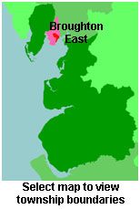
View maps of Broughton East and places within its boundaries.
View a map of the boundaries of this town/parish.
You can see maps centred on OS grid reference SD401783 (Lat/Lon: 54.197306, -2.920062), Broughton East which are provided by:
- OpenStreetMap
- Google Maps
- StreetMap (Current Ordnance Survey maps)
- Bing (was Multimap)
- Old Maps Online
- National Library of Scotland (Old Ordnance Survey maps)
- Vision of Britain (Click "Historical units & statistics" for administrative areas.)
- English Jurisdictions in 1851 (Unfortunately the LDS have removed the facility to enable us to specify a starting location, you will need to search yourself on their map.)
- Magic (Geographic information) (Click + on map if it doesn't show)
- GeoHack (Links to on-line maps and location specific services.)
- All places within the same township/parish shown on an Openstreetmap map.
- Nearby townships/parishes shown on an Openstreetmap map.
- Nearby places shown on an Openstreetmap map.
For probate purposes prior to 1858, Broughton East was in the Archdeaconry of Richmond, in the Diocese of Chester. The original Lancashire wills for the Archdeaconry of Richmond are held at the Lancashire Record Office.
You can also see Family History Societies covering the nearby area, plotted on a map. This facility is being developed, and is awaiting societies to enter information about the places they cover.