
Hide
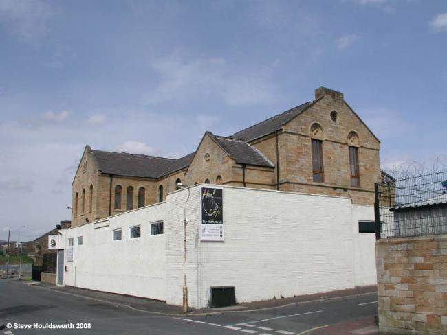
Accrington Road Wesleyan Methodist, Burnley
hide
Hide
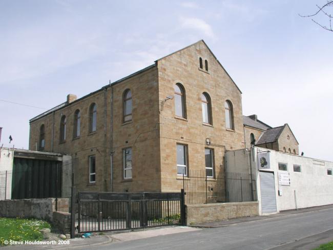
Photograph supplied by & Copyright of Steve Houldsworth.
Hide
Wesleyan Methodist church,
Accrington Road,
Burnley
Lancashire
Accrington Road,
Burnley
Lancashire
Hide
The church strted out at Bartle Hills in 1849. The chapel became too small and so they moved to Accrington Road in 1871. In 1961 they changed the name to Westhill when Howard Street closed and joined them. In 1967 the chapel closed due to dry rot and the school room used for a time as a chapel. It closed in 1971 when the congregation joined "Mount Pisgah" at Myrtle Bank, Cog Lane.
The Wesleyan Methodist church was formed in the 18th century from religous societies founded by John Wesley and his preachers. It suffered many secessions, but was the largest Nonconformist denomination in the 19th century. In 1932 the Wesleyan Methodists joined with the Primitive Methodists and the United Methodists to form the Methodist Church of Great Britain. The Bartle Hills church was located
This site provides historical information about churches, other places of worship and cemeteries. It has no connection with the churches etc. themselves.
Whilst every effort has been made to record exact details of record office and library holdings
you are recommended to check with them before visiting to ensure that they do hold the records and years you
wish to examine. Similarly check with transcript publishers to ensure they cover the records and years
you require before making a purchase.
Original Registers
Baptisms
- 1882-1969 held by Lancashire Record Office MBU 3
- 1882-1969 held by Lancashire Record Office MBU 3
Marriages
- 1876-1931 held by Lancashire Record Office MBU 3
- 1876-1931 held by Lancashire Record Office MBU 3
- 1932-1967 held by Lancashire Record Office MMR 8/41-44
- 1932-1967 held by Lancashire Record Office MMR 8/41-44
It was located at SD8267232442 (Lat/Lon 53.788004, -2.264488). You can see this on maps provided by:
- OpenStreetMap
- Google Maps
- StreetMap (Current Ordnance Survey maps)
- Bing (was Multimap)
- Old Maps Online
- National Library of Scotland (Old Ordnance Survey maps)
- Vision of Britain (Click "Historical units & statistics" for administrative areas.)
- English Jurisdictions in 1851 (Unfortunately the LDS have removed the facility to enable us to specify a starting location, you will need to search yourself on their map.)
- Magic (Geographic information) (Click + on map if it doesn't show)
- GeoHack (Links to on-line maps and location specific services.)