
Hide
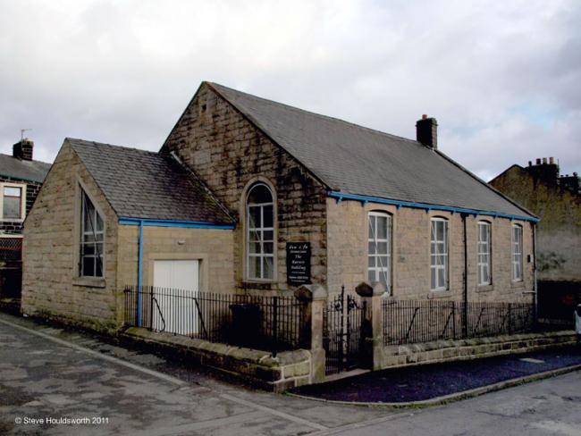
Colne Bethesda Independant Methodist Lancashire
hide
Hide
Photograph supplied by & Copyright of Steve Houldsworth.
Hide
Bethesda,
Blucher Street,
Colne
Lancashire
Blucher Street,
Colne
Lancashire
Hide
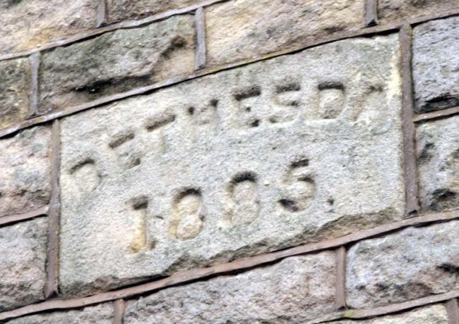
It was founded before 1884. It closed before 2002.
This site provides historical information about churches, other places of worship and cemeteries. It has no connection with the churches etc. themselves.
It was located at SD8914639918 (Lat/Lon 53.855374, -2.166492). You can see this on maps provided by:
- OpenStreetMap
- Google Maps
- StreetMap (Current Ordnance Survey maps)
- Bing (was Multimap)
- Old Maps Online
- National Library of Scotland (Old Ordnance Survey maps)
- Vision of Britain (Click "Historical units & statistics" for administrative areas.)
- English Jurisdictions in 1851 (Unfortunately the LDS have removed the facility to enable us to specify a starting location, you will need to search yourself on their map.)
- Magic (Geographic information) (Click + on map if it doesn't show)
- GeoHack (Links to on-line maps and location specific services.)