
Hide
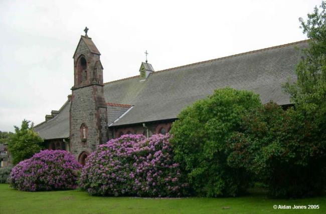
St Margaret, Dalton-in-Furness, Church of England
hide
Hide

Hide
St Margaret,
Ulverston Rd,
Dalton-in-Furness
Lancashire
Hide
Initially a C of E mission church under St Mary's. A temporary iron church was built in 1872, mainly using funds provided by Barrow Haematite Iron & Steel Company. It was superseded by a new stone building in 1901-02. It closed c1980, but the building was subsequently purchased in 1981 by the Roman Catholic authorities as a replacement for their older chapel nearby.
The large increase in population during the last few years rendered more church accommodation necessary, and, through the efforts of the present vicar; an iron church (St. Margaret's), capable of seating 1,000 persons, was erected, in which services are conducted by the Rev. G. W. Cole, B.A.from Mannex's directory of Furness & Cartmel, 1882
Whilst every effort has been made to record exact details of record office and library holdings you are recommended to check with them before visiting to ensure that they do hold the records and years you wish to examine. Similarly check with transcript publishers to ensure they cover the records and years you require before making a purchase.
There were no separate registers for this church as it was a mission of St. Mary's
This site provides historical information about churches, other places of worship and cemeteries. It has no connection with the churches themselves.
- OpenStreetMap
- Google Maps
- StreetMap (Current Ordnance Survey maps)
- Bing (was Multimap)
- Old Maps Online
- National Library of Scotland (Old Ordnance Survey maps)
- Vision of Britain (Click "Historical units & statistics" for administrative areas.)
- English Jurisdictions in 1851 (Unfortunately the LDS have removed the facility to enable us to specify a starting location, you will need to search yourself on their map.)
- Magic (Geographic information) (Click + on map if it doesn't show)
- GeoHack (Links to on-line maps and location specific services.)