
Hide
Failsworth
hide
Hide
hide
Hide
hide
Hide
Hide
FAILSWORTH, a township, a chapelry, and a sub-district, in Manchester parish and district, Lancashire. The township lies on the Rochdale canal, and near the Lancashire and Yorkshire railway, 4½ miles NE by E of Manchester; and has a post office under Manchester. Acres, 1,064. Real property, £16,052; of which £450 are in gas-works. Pop. in 1851, 4,433; in 1861, 5,113. Houses, 1,054. The increase of population arose from the erection of cotton mills and manufactories, the enlargement of a foundry, and the facilities afforded for traffic by canal. The chapelry is conterminate with the township; and was constituted in 1844. The living is a p. curacy in the diocese of Manchester. Value, £211.* Patron, alternately the Crown and the Bishop. The church was built in 1846. There are four dissenting chapels, a Roman Catholic chapel, and national schools. The sub-district includes Moston township. Pop., 8,312.
John Marius Wilson, Imperial Gazetteer of England and Wales (1870-72)
Hide
Local studies information is held at Oldham library.
| Dob Lane, Failsworth, Unitarian |
Details about the census records, and indexes for Failsworth.
| Holy Family, Failsworth, Church of England |
| Holy Trinity Church of England, Failsworth |
| St John, Failsworth, Church of England |
| Ashton Rd East, Congregational, Failsworth |
| Macedonia Congregational, Failsworth |
| Dob Lane, Failsworth, Unitarian |
| St Mary (The Immaculate Conception), Failsworth, Roman Catholic |
| St Mary, Failsworth, Roman Catholic |
The Register Office covering the Failsworth area is Oldham.
The National Gazetteer of Great Britain and Ireland - 1868
"FAILSWORTH, a township in the parish of Manchester, hundred of Salford, county palatine Lancaster, 4 miles N.E. of Manchester. The Rochdale canal and Lancashire and Yorkshire railway pass in the vicinity. This township has vastly increased in population of late years, and contains many well-built houses, occupied by the merchants and manufacturers of Manchester. The living is a perpetual curacy in the diocese of Manchester, value £250, in the patronage of the crown and bishop alternately. There is a National school."
- Ask for a calculation of the distance from Failsworth to another place.
In 1835 Failsworth was a township in the parish of Manchester.
Information about boundaries and administrative areas is available from A Vision of Britain through time.
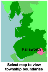
View a map of the boundaries of this town/parish.
You can see maps centred on OS grid reference SD896010 (Lat/Lon: 53.505773, -2.158277), Failsworth which are provided by:
- OpenStreetMap
- Google Maps
- StreetMap (Current Ordnance Survey maps)
- Bing (was Multimap)
- Old Maps Online
- National Library of Scotland (Old Ordnance Survey maps)
- Vision of Britain (Click "Historical units & statistics" for administrative areas.)
- English Jurisdictions in 1851 (Unfortunately the LDS have removed the facility to enable us to specify a starting location, you will need to search yourself on their map.)
- Magic (Geographic information) (Click + on map if it doesn't show)
- GeoHack (Links to on-line maps and location specific services.)
- All places within the same township/parish shown on an Openstreetmap map.
- Nearby townships/parishes shown on an Openstreetmap map.
- Nearby places shown on an Openstreetmap map.
For probate purposes prior to 1858, Failsworth was in the Archdeaconry of Chester, in the Diocese of Chester. The original Lancashire wills for the Archdeaconry of Chester are held at the Lancashire Record Office.
You can also see Family History Societies covering the nearby area, plotted on a map. This facility is being developed, and is awaiting societies to enter information about the places they cover.