
Hide
Garston
hide
Hide
hide
Hide
hide
Hide
Hide
GARSTON, a small town, a township, and a chapelry, in Childwall parish, Lancashire. The town stands on the Mersey, and on the Warrington, Garston, and Liverpool railway, 6 miles SE of Liverpool; was once noted for extensive salt-works; is now a sub-port to Liverpool, with new docks; and has a railway station with telegraph, and a post office under Liverpool. The town ship includes also Aigburth, a suburb of Liverpool. Acres, 3,293; of which 1,665 are water. Real property, £31,643. Pop. in 1851, 2,756; in 1861, 4,720. Houses, 763. The chapelry includes only the eastern part of the township; excludes Aigburth; and was constituted in 1828. Pop., 2,016. Houses, 356. The property is much subdivided. The living is a vicarage in the diocese of Chester. Value, £138.* Patron, Richard Watt, Esq. The church is very good; and there are two dissenting chapels, Church schools, and charities £12.
John Marius Wilson, Imperial Gazetteer of England and Wales (1870-72)
Hide
Details about the census records, and indexes for Garston.
| St Anne, Aigburth, Church of England |
| St Mary, Grassendale, Church of England |
| St Michael Church of England, Garston |
| Garston Old Rd, Congregational, Garston |
| Island Rd United Reformed, Garston |
The Register Office covering the Garston area is Liverpool.
The National Gazetteer of Great Britain and Ireland - 1868
"ST. ANNE AIGBURTH, a hamlet in the chapelry of Garston, parish of Childwall, and hundred of west Derby, in the county palatine of Lancaster, 4 miles to the S.E. of Liverpool. It is on the river Mersey. The living is a curacy in the diocese of Chester, in the patronage of trustees. Aigburth Hall is the chief residence.
"GARSTON, a chapelry in the parish of Childwall, hundred of West Derby, county palatine Lancaster, 5 miles S.E. of Liverpool, its post town. It is situated on the river Mersey, and includes the townships of Aigburth and Speke, and is a station on a branch line of the Stockport and Warrington railway. Extensive salt-works give employment to most of the inhabitants. There is a district church, the living of which is a perpetual curacy in the diocese of Chester, value £138. The charities produce about £12 yearly."
John Marius Wilson, Imperial Gazetteer of England and Wales - 1870-2
- Ask for a calculation of the distance from Garston to another place.
In 1835 Garston was a township in the parish of Childwall.
Information about boundaries and administrative areas is available from A Vision of Britain through time.
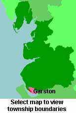
View a map of the boundaries of this town/parish.
You can see maps centred on OS grid reference SJ394851 (Lat/Lon: 53.358983, -2.91158), Garston which are provided by:
- OpenStreetMap
- Google Maps
- StreetMap (Current Ordnance Survey maps)
- Bing (was Multimap)
- Old Maps Online
- National Library of Scotland (Old Ordnance Survey maps)
- Vision of Britain (Click "Historical units & statistics" for administrative areas.)
- English Jurisdictions in 1851 (Unfortunately the LDS have removed the facility to enable us to specify a starting location, you will need to search yourself on their map.)
- Magic (Geographic information) (Click + on map if it doesn't show)
- GeoHack (Links to on-line maps and location specific services.)
- All places within the same township/parish shown on an Openstreetmap map.
- Nearby townships/parishes shown on an Openstreetmap map.
- Nearby places shown on an Openstreetmap map.
For probate purposes prior to 1858, Garston was in the Archdeaconry of Chester, in the Diocese of Chester. The original Lancashire wills for the Archdeaconry of Chester are held at the Lancashire Record Office.
You can also see Family History Societies covering the nearby area, plotted on a map. This facility is being developed, and is awaiting societies to enter information about the places they cover.