
Hide
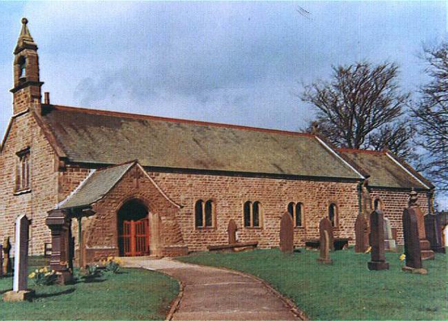
St James, Whitechapel, Church of England
hide
Hide
Hide
St James,
Church Lane,
Whitechapel
Lancashire
Hide
It was founded before 1650.
This site provides historical information about churches, other places of worship and cemeteries. It has no connection with the churches themselves. For current information you should contact them directly.
1818-1838
Original Registers of baptisms 1818-1838 held by Lancashire Archives - PR 3248
1818-1838
Copy of Original Register of baptisms 1818-1838 held by Lancashire Archives - Searchroom
1819-1871
Copy of Bishop's Transcript of baptisms 1819-1871 held by Lancashire Archives - DRB 2/122b
Burials
1818-1903
Copy of Original Register of burials 1818-1903 held by Lancashire Archives - Searchroom
1818-1992
Original Registers of burials 1818-1992 held by Lancashire Archives - PR 3248
1819-1871
Copy of Bishop's Transcript of burials 1819-1871 held by Lancashire Archives - DRB 2/122b
It is located at SD5592641298 (Lat/Lon 53.866014, -2.6717). You can see this on maps provided by:
- OpenStreetMap
- Google Maps
- StreetMap (Current Ordnance Survey maps)
- Bing (was Multimap)
- Old Maps Online
- National Library of Scotland (Old Ordnance Survey maps)
- Vision of Britain (Click "Historical units & statistics" for administrative areas.)
- English Jurisdictions in 1851 (Unfortunately the LDS have removed the facility to enable us to specify a starting location, you will need to search yourself on their map.)
- Magic (Geographic information) (Click + on map if it doesn't show)
- GeoHack (Links to on-line maps and location specific services.)