
Hide
Great Lever
hide
Hide
hide
Hide
hide
Hide
Hide
LEVER (GREAT), a township-chapelry, with a village, in Middleton parish, Lancashire; on the Lancashire and Yorkshire railway, near the Bolton and Bury canal, 1½ mile SSE of Bolton r. station. Post town, Bolton. Acres, 770. Real property, £10,174; of which £3,750 are in mines. Pop., 722. Houses, 138. Most of the land belongs to the Earl of Bradford and the Earl of Ellesmere. There are some good residences; and there are chemical-works, bleaching-works, and collieries. The living is a p. curacy in the diocese of Manchester. Value, £130. Patron, the Earl of Bradford. The church is in the early and decorated English styles; and consists of nave and chancel, with a bell-turret.
John Marius Wilson, Imperial Gazetteer of England and Wales (1870-72)
Hide
Local studies information is held at Bolton library.
Details about the census records, and indexes for Great Lever.
The Register Office covering the Great Lever area is Bolton.
The National Gazetteer of Great Britain and Ireland - 1868
"GREAT LEVER, a township in the parish of Middleton, hundred of Salford, county Lancaster, 1½ mile S. of Great Bolton, its post town and railway station. The village, which is small, is situated on the great road from Bolton to Manchester. There are collieries, chemical works, and bleach grounds. The living is a perpetual curacy in the diocese of Manchester, value £33. The church, dedicated to St. Michael, is a modern edifice, with a turret containing two bells. Adjoining the church is a school for both sexes, also a Sunday-school.
- Ask for a calculation of the distance from Great Lever to another place.
In 1835 Great Lever was a township in the parish of Middleton.
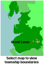
View a map of the boundaries of this town/parish.
You can see maps centred on OS grid reference SD723074 (Lat/Lon: 53.562403, -2.419948), Great Lever which are provided by:
- OpenStreetMap
- Google Maps
- StreetMap (Current Ordnance Survey maps)
- Bing (was Multimap)
- Old Maps Online
- National Library of Scotland (Old Ordnance Survey maps)
- Vision of Britain (Click "Historical units & statistics" for administrative areas.)
- English Jurisdictions in 1851 (Unfortunately the LDS have removed the facility to enable us to specify a starting location, you will need to search yourself on their map.)
- Magic (Geographic information) (Click + on map if it doesn't show)
- GeoHack (Links to on-line maps and location specific services.)
- All places within the same township/parish shown on an Openstreetmap map.
- Nearby townships/parishes shown on an Openstreetmap map.
- Nearby places shown on an Openstreetmap map.
For probate purposes prior to 1858, Great Lever was in the Archdeaconry of Chester, in the Diocese of Chester. The original Lancashire wills for the Archdeaconry of Chester are held at the Lancashire Record Office.
You can also see Family History Societies covering the nearby area, plotted on a map. This facility is being developed, and is awaiting societies to enter information about the places they cover.