
Hide
Halewood
hide
Hide
hide
Hide
hide
Hide
Hide
HALEWOOD, a township in Childwall parish, and a chapelry partly also in Huyton parish, Lancashire. The township lies on the Garston and Warrington railway, near the river Mersey, 5½ miles E of Garston; includes the hamlet of Hale Bank; and has a station on the railway, and a post office under Liverpool. Acres, 3, 759. Real property, £7,250. Pop. in 1851, 1,146; in 1861, 1,205. Houses, 219. The manor belongs to the Earl of Derby. The chapelry includes only part of the township, and was constituted in 1844. Pop. in 1861, 1,184. Houses, 214. Pop. of the part in H. township, 835. Houses, 149. The living is a rectory in the diocese of Chester. Value, £300.* Patron, the Vicar of Childwall. The church was built in 1839, and enlarged in 1847; and is in the early English style. There are a Wesleyan chapel and a national school.
John Marius Wilson, Imperial Gazetteer of England and Wales (1870-72)
Hide
Local studies information is held at Knowsley library.
Details about the census records, and indexes for Halewood.
The Register Office covering the Halewood area is Knowsley.
The National Gazetteer of Great Britain and Ireland - 1868
"HALEWOOD, a township in the parish of Childwall, hundred of West Derby, county Lancaster, 5 miles S. of Prescot, its post town. It is situated near the river Mersey, and the Manchester and Garston section of the London and North-Western railway has a station in the village. The tithes have been commuted for a rent-charge of £394 18s. 8d. The village is considerable. The living is a perpetual curacy in the diocese of Chester, and in the patronage of the Vicar of Childwall. The church is a small ancient structure situated at Woolton."
- Ask for a calculation of the distance from Halewood to another place.
In 1835 Halewood was a township in the parish of Childwall.
Some information about the history of Halewood.
View maps of Halewood and places within its boundaries.
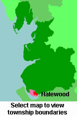
View a map of the boundaries of this town/parish.
You can see maps centred on OS grid reference SJ463848 (Lat/Lon: 53.357265, -2.807554), Halewood which are provided by:
- OpenStreetMap
- Google Maps
- StreetMap (Current Ordnance Survey maps)
- Bing (was Multimap)
- Old Maps Online
- National Library of Scotland (Old Ordnance Survey maps)
- Vision of Britain (Click "Historical units & statistics" for administrative areas.)
- English Jurisdictions in 1851 (Unfortunately the LDS have removed the facility to enable us to specify a starting location, you will need to search yourself on their map.)
- Magic (Geographic information) (Click + on map if it doesn't show)
- GeoHack (Links to on-line maps and location specific services.)
- All places within the same township/parish shown on an Openstreetmap map.
- Nearby townships/parishes shown on an Openstreetmap map.
- Nearby places shown on an Openstreetmap map.
For probate purposes prior to 1858, Halewood was in the Archdeaconry of Chester, in the Diocese of Chester. The original Lancashire wills for the Archdeaconry of Chester are held at the Lancashire Record Office.
For probate purposes prior to 1858, Halewood was in the Archdeaconry of Chester, in the Diocese of Chester. The original Lancashire wills for the Archdeaconry of Chester are held at the Lancashire Record Office.
You can also see Family History Societies covering the nearby area, plotted on a map. This facility is being developed, and is awaiting societies to enter information about the places they cover.