
Hide
St Mary, Halewood, Church of England
hide
Hide
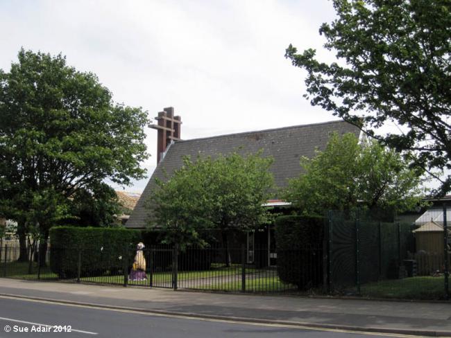
Photograph supplied by & © Copyright of Sue Adair.
Hide
Hide
It was founded in 1967.
St Mary's began in 1967 as a shared Anglican-Methodist building and is located on Leathers Lane, in the South Ward of Halewood. The church has a flexible, modern, multi-purpose building, which was rebuilt in 1974 following a fire which destroyed the original church building in 1972.
This site provides historical information about churches, other places of worship and cemeteries. It has no connection with the churches etc. themselves. For current information you should contact them directly.
It is located at SJ4491185248 (Lat/Lon 53.361221, -2.829244). You can see this on maps provided by:
- OpenStreetMap
- Google Maps
- StreetMap (Current Ordnance Survey maps)
- Bing (was Multimap)
- Old Maps Online
- National Library of Scotland (Old Ordnance Survey maps)
- Vision of Britain (Click "Historical units & statistics" for administrative areas.)
- English Jurisdictions in 1851 (Unfortunately the LDS have removed the facility to enable us to specify a starting location, you will need to search yourself on their map.)
- Magic (Geographic information) (Click + on map if it doesn't show)
- GeoHack (Links to on-line maps and location specific services.)