
Hide
Hapton
hide
Hide
hide
Hide
hide
Hide
Hide
HAPTON, a township in Whalley parish, Lancashire; on the East Lancashire railway and on the Liverpool and Leeds canal, 3 miles WSW of Burnley. It has a station on the railway. Acres, 3,570. Real property, £8,634; of which £4,520 are in mines, and £300 in quarries. Pop. in l851, 550; in 1861, 1,003. Houses, 177. The increase of pop. arose from the extension of cotton spinning. There are also chemical works. Old seats here belonged to the Haberghams and the Shuttleworths; and the chief property now belongs to Charles Townley, Esq. There is an endowed school; and the schoolroom is used for religions worship.
John Marius Wilson, Imperial Gazetteer of England and Wales (1870-72)
Hide
Local studies information is held at Burnley library.
Details about the census records, and indexes for Hapton.
The Register Office covering the Hapton area is Burnley and Pendle.
The National Gazetteer of Great Britain and Ireland - 1868
"HAPTON, a township in the parish of Whalley, higher division of the hundred of Blackburn, county Lancaster, 2 miles S. of Padiham, and 4 W. of Burnley. It is situated on the high road from Accrington to Burnley, and near the Leeds and Liverpool canal. The Lancashire and Yorkshire railway passes through the township, and has a station in the village. The soil is light, and most of the inhabitants are employed in agriculture. A great number of hands are engaged in the cotton and chemical works, and in the stone quarries. There is an endowed school, but neither church nor chapel."
- Ask for a calculation of the distance from Hapton to another place.
In 1835 Hapton was a township in the parish of Whalley.
Information about boundaries and administrative areas is available from A Vision of Britain through time.
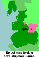
View a map of the boundaries of this town/parish.
You can see maps centred on OS grid reference SD805305 (Lat/Lon: 53.770707, -2.296701), Hapton which are provided by:
- OpenStreetMap
- Google Maps
- StreetMap (Current Ordnance Survey maps)
- Bing (was Multimap)
- Old Maps Online
- National Library of Scotland (Old Ordnance Survey maps)
- Vision of Britain (Click "Historical units & statistics" for administrative areas.)
- English Jurisdictions in 1851 (Unfortunately the LDS have removed the facility to enable us to specify a starting location, you will need to search yourself on their map.)
- Magic (Geographic information) (Click + on map if it doesn't show)
- GeoHack (Links to on-line maps and location specific services.)
- All places within the same township/parish shown on an Openstreetmap map.
- Nearby townships/parishes shown on an Openstreetmap map.
- Nearby places shown on an Openstreetmap map.
For probate purposes prior to 1858, Hapton was in the Archdeaconry of Chester, in the Diocese of Chester. The original Lancashire wills for the Archdeaconry of Chester are held at the Lancashire Record Office.
You can also see Family History Societies covering the nearby area, plotted on a map. This facility is being developed, and is awaiting societies to enter information about the places they cover.