
Hide
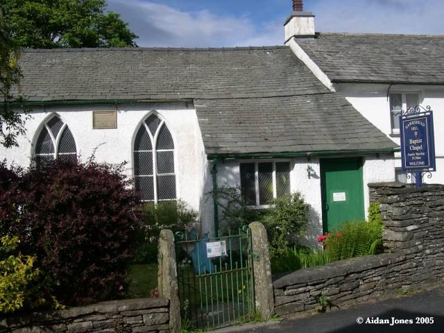
Hawkshead Hill Baptist
hide
Hide


Hide
Hawkshead Hill
Lancashire
Hide
Four of the earliest gravestones were recorded in 1892 by Henry Swainson Cowper in his short book "The Monumental Inscriptions in the parish church and churchyard of Hawkshead, Lancashire and in the burial grounds of Satterthwaite, the Baptists at Hawkshead Hill and the Quakers at Colthouse". All twelve stones were subsequently recorded in the "Hawkshead Hill Millennium Project", a compendium compiled by village residents, including local illustrations, maps and historical notes, 2000-2001. (There is a copy in Cumbria Record Office, Barrow.)
The datestone on the wall reads: "BAPTIST CHAPEL BUILT A.D 1678 RESTORED A.D 1876".
The baptistry pool, in the chapel grounds, was first mentioned in local records during the 1740s, at the time when the burial ground was being consecrated. Persons wishing to be baptised now have a choice: an indoor baptistry was first installed in the 1930s; the outdoor baptistry pool was last used in July 2004, whilst in recent years the nearby waters of Tarn Hows have also been used.
This site provides historical information about churches, other places of worship and cemeteries. It has no connection with the churches themselves. For current information you should contact them directly.
Register Transcripts
MI
- 1750-1863 held by Lancashire Record Office Searchroom - Printed
- 1750-1863 held by Lancashire Record Office Searchroom - Printed
- OpenStreetMap
- Google Maps
- StreetMap (Current Ordnance Survey maps)
- Bing (was Multimap)
- Old Maps Online
- National Library of Scotland (Old Ordnance Survey maps)
- Vision of Britain (Click "Historical units & statistics" for administrative areas.)
- English Jurisdictions in 1851 (Unfortunately the LDS have removed the facility to enable us to specify a starting location, you will need to search yourself on their map.)
- Magic (Geographic information) (Click + on map if it doesn't show)
- GeoHack (Links to on-line maps and location specific services.)