
Hide
Heyhouses
hide
Hide
hide
Hide
hide
Hide
Hide
"HEYHOUSES, a township and a chapelry in Whalley parish, Lancashire. The township lies in Pendle forest, adjacent to Sabden village, 4½ miles SE by S of Clitheroe r. station; and was at one time extra-parochial. Acres, 320. Real property, £460. Pop., 128. Houses, 28. The chapelry also includes part of Sabden, which has a post office under Blackburn; and it was constituted in 1849. Pop., 1,616. Houses, 339. The manor belongs to the Duke of Buccleuch. The living is a p. curacy in the diocese of Manchester. Value, £150.* Patron, L. G. N. Starkie, Esq. The church was built in 1842; is in the Norman style; and consists of nave and chancel, with tower and spire. There is a national school, with an endowment of £10 a year."
John Marius Wilson, Imperial Gazetteer of England and Wales (1870-72)
Hide
Local studies information is held at Clitheroe library.
| Clitheroe Rd, Sabden, Baptist |
| Wesley Street Wesleyan Methodist, Sabden |
| St Mary, Sabden, Roman Catholic |
Details about the census records, and indexes for Heyhouses.
| Clitheroe Rd, Sabden, Baptist |
| Wesley Street Wesleyan Methodist, Sabden |
| St Mary, Sabden, Roman Catholic |
The Register Office covering the Heyhouses area is Burnley and Pendle.
The National Gazetteer of Great Britain and Ireland - 1868
"HEYHOUSES, a township in the parish of Whalley, hundred of Blackburn, county Lancaster, 3 miles S.E. of Clitheroe."
- Ask for a calculation of the distance from Heyhouses to another place.
In 1835 Heyhouses was a township in the parish of Whalley.
View maps of Heyhouses and places within its boundaries.
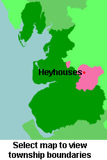
View a map of the boundaries of this town/parish.
You can see maps centred on OS grid reference SD786377 (Lat/Lon: 53.834767, -2.326671), Heyhouses which are provided by:
- OpenStreetMap
- Google Maps
- StreetMap (Current Ordnance Survey maps)
- Bing (was Multimap)
- Old Maps Online
- National Library of Scotland (Old Ordnance Survey maps)
- Vision of Britain (Click "Historical units & statistics" for administrative areas.)
- English Jurisdictions in 1851 (Unfortunately the LDS have removed the facility to enable us to specify a starting location, you will need to search yourself on their map.)
- Magic (Geographic information) (Click + on map if it doesn't show)
- GeoHack (Links to on-line maps and location specific services.)
- All places within the same township/parish shown on an Openstreetmap map.
- Nearby townships/parishes shown on an Openstreetmap map.
- Nearby places shown on an Openstreetmap map.
For probate purposes prior to 1858, Heyhouses was in the Archdeaconry of Chester, in the Diocese of Chester. The original Lancashire wills for the Archdeaconry of Chester are held at the Lancashire Record Office.
You can also see Family History Societies covering the nearby area, plotted on a map. This facility is being developed, and is awaiting societies to enter information about the places they cover.