
Hide
Ince in Makerfield
hide
Hide
hide
Hide
hide
Hide
Hide
"INCE-IN-MAKERFIELD, a township and a chapelry in Wigan parish, Lancashire. The township lies on the Leeds and Liverpool canal, the Lancashire and Yorkshire railway, and the London and Northwestern railway, 1¼ mile SW of Wigan; and has a station on the L. and Y. railway, and a post office under Wigan, both of the name of Ince. Acres, 2,314. Real property, £69,829; of which £56,920 are in mines, and £30 in the canal. Pop. in 1851, 3,670; in 1861, 8,266. Houses, 1,533. The increase of pop. arose mainly from the extension of mining and manufacturing operations. A fine cannel coal is found; an excellent common coal is very largely worked; and there are extensive iron works, some cotton mills, and chemical works. Ince Hall, formerly the seat of the Gerard family, is a curious, half timbered, ancient structure. The cemetery of Ince, comprising 4 acres, and a cemetery of Wigan, comprising 18 acres, are within the township. The chapelry is nearly conterminate with the township, and was constituted in 1862. The living is a vicarage in the diocese of Chester. Value, £300. Patrons, Simeon's Trustees. The church was built in 1864, at a cost of £6,000. There are three national schools; two of them built in 1866."
John Marius Wilson, Imperial Gazetteer of England and Wales (1870-72)
Hide
Local studies information is held at Wigan library.
Details about the census records, and indexes for Ince in Makerfield.
| Christ Church, Ince in Makerfield, Church of England |
| St Mary Church of England, Ince in Makerfield |
| Ince in Makerfield, St William, Roman Catholic |
The Register Office covering the Ince in Makerfield area is Wigan and Leigh.
INCE is a township in the parish of Wigan, adjoining to that town upon the east. The manor of Ince anciently belonged to a family of that name, and came into the possession of the Gerards as early as 1259. The present owner of the manor house is Capt. John Walmsley, of Bath, whose father purchased it from a descendant of the Gerards. In 1821 the township of Ince contained nearly 1,400 inhabitants.Pigot's Royal National and Commercial Directory and Topography of the county of Lancashire (1828)
The National Gazetteer of Great Britain and Ireland - 1868
"INCE-IN-MAKERFIELD, a township in the parish of Wigan, hundred of West Derby, county Lancaster, adjoining the borough of Wigan. It is a station on the Lancashire and Yorkshire, and is crossed by the London and North-Western railway. The Leeds and Liverpool canal runs through the township. It is celebrated for a species of coal called "cannel," which is found here in large quantities, and the works of which employ a large number of the inhabitants. There are extensive iron and chemical works, and cotton mills, in which a great number of hands are engaged. The principal residence is Ince Hall, formerly the seat of the Gerard family. There are two cemeteries at Ince, one for its own use, and the other belonging to the town of Wigan, situated on either side of the London and North-Western railway. There is a National school."
- Ask for a calculation of the distance from Ince in Makerfield to another place.
In 1835 Ince in Makerfield was a township in the parish of Wigan.
Information about boundaries and administrative areas is available from A Vision of Britain through time.
View maps of Ince in Makerfield and places within its boundaries.
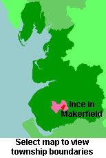
View a map of the boundaries of this town/parish.
You can see maps centred on OS grid reference SD597042 (Lat/Lon: 53.53252, -2.608866), Ince in Makerfield which are provided by:
- OpenStreetMap
- Google Maps
- StreetMap (Current Ordnance Survey maps)
- Bing (was Multimap)
- Old Maps Online
- National Library of Scotland (Old Ordnance Survey maps)
- Vision of Britain (Click "Historical units & statistics" for administrative areas.)
- English Jurisdictions in 1851 (Unfortunately the LDS have removed the facility to enable us to specify a starting location, you will need to search yourself on their map.)
- Magic (Geographic information) (Click + on map if it doesn't show)
- GeoHack (Links to on-line maps and location specific services.)
- All places within the same township/parish shown on an Openstreetmap map.
- Nearby townships/parishes shown on an Openstreetmap map.
- Nearby places shown on an Openstreetmap map.
For probate purposes prior to 1858, Ince in Makerfield was in the Archdeaconry of Chester, in the Diocese of Chester. The original Lancashire wills for the Archdeaconry of Chester are held at the Lancashire Record Office.
You can also see Family History Societies covering the nearby area, plotted on a map. This facility is being developed, and is awaiting societies to enter information about the places they cover.