
Hide
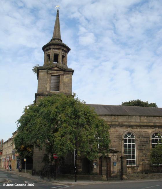
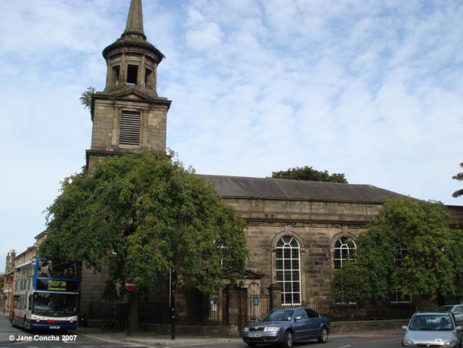
St John, Lancaster, Church of England
hide
Hide
Photograph supplied by & Copyright of Jane Concha.
Hide
St John,
Chapel St, Green Ayre,
Lancaster
Lancashire
Chapel St, Green Ayre,
Lancaster
Lancashire
Hide
1767-1939
Transcript of monumental inscriptions 1767-1939 held by Lancashire Archives - Searchroom
It was founded in 1755 and closed in 1981.
St. John's Church, Green Ayre, is a neat stone edifice, erected in 1755, surmounted by a spire added in 1784, the gift of Thomas Bowes, Esq. The population of the district assigned to the church is about 1,825. The living is a vicarage, value £200, in the gift of the Vicar of Lancaster, and held by the Rev. J. L. Gamble, M.A. In 1757 the living was augmented with £800, of which £400 was obtained from Queen Anne's bounty.from Bulmer's History and Directory of Lancaster & District, 1912
This site provides historical information about churches, other places of worship and cemeteries. It has no connection with the churches etc. themselves.
Baptisms
1755-1813
Original Registers of baptisms 1755-1813 held by Lancashire Archives - PR 3262 3264
1755-1813
Transcript of baptisms - 1755-1813 by the Lancashire Parish Register Society - Volume 192
1842-1859
Copy of Bishop's Transcript of baptisms 1842-1859 held by Lancashire Archives - DRB 2/132
1842-1958
Original Registers of baptisms 1842-1958 held by Lancashire Archives - PR 3262 3264
Marriages
1842-1944
Original Registers of marriages 1842-1944 held by Lancashire Archives - PR 3262 3264
1847-1853
Copy of Bishop's Transcript of marriages 1847-1853 held by Lancashire Archives - DRB 2/132
Burials
1757-1813
Transcript of burials 1757-1813 by the Lancashire Parish Register Society - Volume 192
1757-1813
Original Registers of burials 1757-1813 held by Lancashire Archives - PR 3262 3264
1842-1854
Original Registers of burials 1842-1854 held by Lancashire Archives - PR 3262 3264
1842-1859
Copy of Bishop's Transcript of burials 1842-1859 held by Lancashire Archives - DRB 2/132
1940-1947
Original Registers of burials 1940-1947 held by Lancashire Archives - PR 3262 3264
It was located at SD4778161901 (Lat/Lon 54.050411, -2.799074). You can see this on maps provided by:
- OpenStreetMap
- Google Maps
- StreetMap (Current Ordnance Survey maps)
- Bing (was Multimap)
- Old Maps Online
- National Library of Scotland (Old Ordnance Survey maps)
- Vision of Britain (Click "Historical units & statistics" for administrative areas.)
- English Jurisdictions in 1851 (Unfortunately the LDS have removed the facility to enable us to specify a starting location, you will need to search yourself on their map.)
- Magic (Geographic information) (Click + on map if it doesn't show)
- GeoHack (Links to on-line maps and location specific services.)