
Hide
Little Lever
hide
Hide
hide
Hide
hide
Hide
Hide
Lever, Little, township and vil., Bolton le Moors par., SE. Lancashire, 3 miles SE. of Bolton, 807 ac., pop. 4413; P.O., T.O.; has cotton mills, paper works, chemical and bleaching works, and collieries.
John Bartholomew, Gazetteer of the British Isles (1887)
Hide
Local studies information is held at Bolton library.
| Christ Church United Reformed, Little Lever |
| Market St Congregational, Little Lever |
| Christ Church Methodist, Little Lever |
Details about the census records, and indexes for Little Lever.
| Christ Church United Reformed, Little Lever |
| Market St Congregational, Little Lever |
| Christ Church Methodist, Little Lever |
| St Teresa, Little Lever, Roman Catholic |
The Register Office covering the Little Lever area is Bolton.
The National Gazetteer of Great Britain and Ireland - 1868
"LITTLE LEVER, a chapelry in the parish of Bolton-le-Moors, hundred of Salford, county Lancaster, 3 miles S.E. of Great Bolton, its post town, and. 1 mile N.W. of Bradley Fold station on the Liverpool and Bury line of railway. It is situated at the junction of the Bolton and Bury and the Bolton and Manchester canals, being bounded on the W. by the river Irwell. There are several collieries, cotton-mills, chemical works, and bleach-grounds. The village is populous. Most of the houses are modern. The living is a perpetual curacy in the diocese of Manchester, value £150, in the patronage of the Vicar of Bolton. The church, dedicated to St. Matthew the Evangelist, is a small structure of brick, with a turret containing one bell. There are National and Sunday schools. The Wesleyans and Independents have places of worship. Lever Hall, an ancient building, was once occupied by Bishop Bridgeman.
- Ask for a calculation of the distance from Little Lever to another place.
In 1835 Little Lever was a township in the parish of Bolton.
View maps of Little Lever and places within its boundaries.
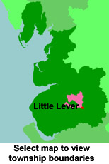
View a map of the boundaries of this town/parish.
You can see maps centred on OS grid reference SD754072 (Lat/Lon: 53.56049, -2.373578), Little Lever which are provided by:
- OpenStreetMap
- Google Maps
- StreetMap (Current Ordnance Survey maps)
- Bing (was Multimap)
- Old Maps Online
- National Library of Scotland (Old Ordnance Survey maps)
- Vision of Britain (Click "Historical units & statistics" for administrative areas.)
- English Jurisdictions in 1851 (Unfortunately the LDS have removed the facility to enable us to specify a starting location, you will need to search yourself on their map.)
- Magic (Geographic information) (Click + on map if it doesn't show)
- GeoHack (Links to on-line maps and location specific services.)
- All places within the same township/parish shown on an Openstreetmap map.
- Nearby townships/parishes shown on an Openstreetmap map.
- Nearby places shown on an Openstreetmap map.
For probate purposes prior to 1858, Little Lever was in the Archdeaconry of Chester, in the Diocese of Chester. The original Lancashire wills for the Archdeaconry of Chester are held at the Lancashire Record Office.
You can also see Family History Societies covering the nearby area, plotted on a map. This facility is being developed, and is awaiting societies to enter information about the places they cover.