
Hide
Greenbank Drive, Jewish, Liverpool
hide
Hide
Photograph supplied by & © Copyright of Lynda Nicholls.
Hide
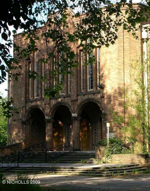
The Synagogue,
Greenbank Drive,
Liverpool
Lancashire
Greenbank Drive,
Liverpool
Lancashire
Hide
It was founded in 1937 and closed on 5 January 2008.
It is a Grade II listed building in Art Deco style, designed by Alfred Ernest Shennan. During WWII it was a refuge for people who had lost their homes and possessions in the blitz.
This site provides historical information about churches, other places of worship and cemeteries. It has no connection with the churches etc. themselves.
It was located at SJ3830988449 (Lat/Lon 53.389259, -2.92906). You can see this on maps provided by:
- OpenStreetMap
- Google Maps
- StreetMap (Current Ordnance Survey maps)
- Bing (was Multimap)
- Old Maps Online
- National Library of Scotland (Old Ordnance Survey maps)
- Vision of Britain (Click "Historical units & statistics" for administrative areas.)
- English Jurisdictions in 1851 (Unfortunately the LDS have removed the facility to enable us to specify a starting location, you will need to search yourself on their map.)
- Magic (Geographic information) (Click + on map if it doesn't show)
- GeoHack (Links to on-line maps and location specific services.)