
Hide
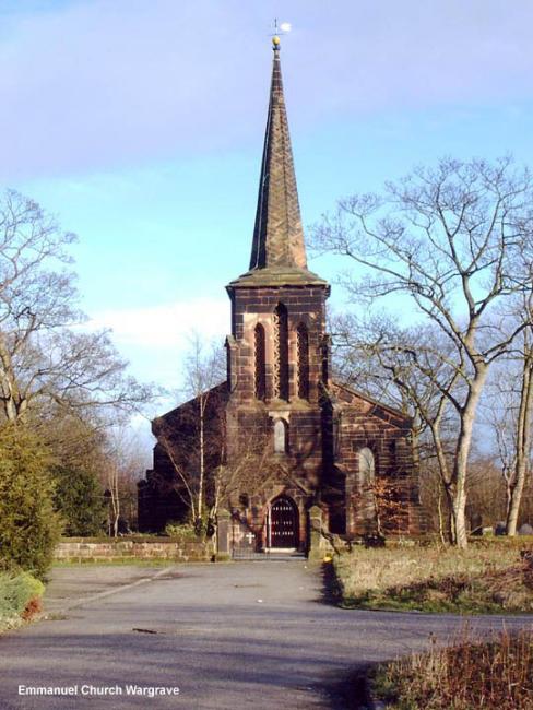
Emmanuel, Newton in Makerfield, Church of England
hide
Hide
Photograph supplied by & Copyright of Eric Cross.
Hide
Emmanuel,
Wargrave Road,
Newton in Makerfield
Wargrave Road,
Newton in Makerfield
Hide
It was founded in 1841.
This site provides historical information about churches, other places of worship and cemeteries. It has no connection with the churches themselves. For current information you should contact them directly.
Baptisms
1845-1855
Copy of Bishop's Transcript of baptisms 1845-1855 held by Lancashire Archives - DRL 2/552
1893
Copy of Bishop's Transcript of baptisms 1893 held by Lancashire Archives - DRL 2/552
Marriages
1845-1855
Copy of Bishop's Transcript of marriages 1845-1855 held by Lancashire Archives - DRL 2/552
Burials
1845-1855
Copy of Bishop's Transcript of burials 1845-1855 held by Lancashire Archives - DRL 2/552
1893
Copy of Bishop's Transcript of burials 1893 held by Lancashire Archives - DRL 2/552
It is located at SJ5834894496 (Lat/Lon 53.445574, -2.628576). You can see this on maps provided by:
- OpenStreetMap
- Google Maps
- StreetMap (Current Ordnance Survey maps)
- Bing (was Multimap)
- Old Maps Online
- National Library of Scotland (Old Ordnance Survey maps)
- Vision of Britain (Click "Historical units & statistics" for administrative areas.)
- English Jurisdictions in 1851 (Unfortunately the LDS have removed the facility to enable us to specify a starting location, you will need to search yourself on their map.)
- Magic (Geographic information) (Click + on map if it doesn't show)
- GeoHack (Links to on-line maps and location specific services.)