
Hide
Newton with Scales
hide
Hide
hide
Hide
hide
Hide
Hide
NEWTON, a township, conjoint with Scales, in Kirkham parish, Lancashire; on the river Ribble, and adjacent to the Preston and Wyre railway, 1¼ mile E S E of Kirkham. Acres, 1,525; of which 295 are water. Real property, £2,647. Pop., 286. Houses, 62. The property is subdivided. A blue-coat school, for maintaining, clothing, and educating poor native boys and girls, was founded here in 1707, by John Hornbie; was re-built in 1864; and has an endowed income of about £600.
John Marius Wilson, Imperial Gazetteer of England and Wales (1870-72)
Hide
Local studies information is held at Kirkham library.
Details about the census records, and indexes for Newton with Scales.
The Register Office covering the Newton with Scales area is Blackpool & Fylde.
The National Gazetteer of Great Britain and Ireland - 1868
"SCALES, a hamlet in the parish of Kirkham, hundred of Amounderness, county Lancaster, 2 miles S.E. of Kirkham. It is in conjunction with Newton to form a township"
"NEWTON-WITH-SCALES, a township in the parish of Kirkham, hundred of Amounderness, county Lancaster, 1 mile S.E. of Kirkham, and 7 miles W. of Preston. It is a small straggling village, situated near the Fylde-road, from Kirkham to Preston. The inhabitants are chiefly engaged in agriculture. This township is in conjunction with Clifton-with-Salwivick. The inhabitants frequent the small chapel of Lund. There is a blue-coat school, founded in 1707 by John Hornby, for the maintenance, clothing, and education of boys of this township, the annual income of which now amounts to about £700."
- Ask for a calculation of the distance from Newton with Scales to another place.
In 1835 Newton with Scales was a township in the parish of Kirkham.
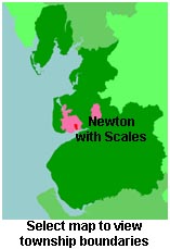
View maps of Newton with Scales and places within its boundaries.
View a map of the boundaries of this town/parish.
You can see maps centred on OS grid reference SD446300 (Lat/Lon: 53.763431, -2.841763), Newton with Scales which are provided by:
- OpenStreetMap
- Google Maps
- StreetMap (Current Ordnance Survey maps)
- Bing (was Multimap)
- Old Maps Online
- National Library of Scotland (Old Ordnance Survey maps)
- Vision of Britain (Click "Historical units & statistics" for administrative areas.)
- English Jurisdictions in 1851 (Unfortunately the LDS have removed the facility to enable us to specify a starting location, you will need to search yourself on their map.)
- Magic (Geographic information) (Click + on map if it doesn't show)
- GeoHack (Links to on-line maps and location specific services.)
- All places within the same township/parish shown on an Openstreetmap map.
- Nearby townships/parishes shown on an Openstreetmap map.
- Nearby places shown on an Openstreetmap map.
For probate purposes prior to 1858, Newton with Scales was in the Archdeaconry of Richmond, in the Diocese of Chester. The original Lancashire wills for the Archdeaconry of Richmond are held at the Lancashire Record Office.
You can also see Family History Societies covering the nearby area, plotted on a map. This facility is being developed, and is awaiting societies to enter information about the places they cover.