
Hide
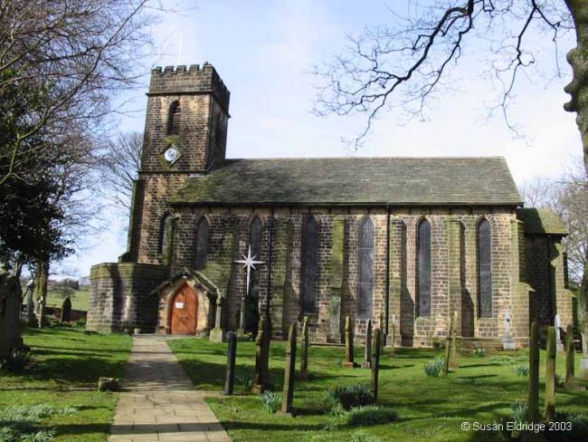
St Anne, Fence, Church of England
hide
Hide
Hide
St Anne,
Wheatley Lane Road,
Fence
Lancashire
Hide
Transcript of monumental inscriptions held by Lancashire Archives - Searchroom
1826-1980
Transcript of monumental inscriptions 1826-1980 held by Lancashire Archives - Searchroom
Baptisms
1837-1846
Copy of Bishop's Transcript of baptisms 1837-1846 held by Lancashire Archives - DRB 2/245 DRB Additions
1837-1983
Original Registers of baptisms 1837-1983 held by Lancashire Archives - PR 3175
1871-1874
Copy of Bishop's Transcript of baptisms 1871-1874 held by Lancashire Archives - DRB 2/245 DRB Additions
Marriages
1837-1846
Copy of Bishop's Transcript of marriages 1837-1846 held by Lancashire Archives - DRB 2/245 DRB Additions
1838-1981
Original Registers of marriages 1838-1981 held by Lancashire Archives - PR 3175
1871-1874
Copy of Bishop's Transcript of marriages 1871-1874 held by Lancashire Archives - DRB 2/245 DRB Additions
Burials
1837-1846
Copy of Bishop's Transcript of burials 1837-1846 held by Lancashire Archives - DRB 2/245 DRB Additions
1837-1899
Original Registers of burials 1837-1899 held by Lancashire Archives - PR 3175
1871-1874
Copy of Bishop's Transcript of burials 1871-1874 held by Lancashire Archives - DRB 2/245 DRB Additions
It is located at SD8246637159 (Lat/Lon 53.830393, -2.267886). You can see this on maps provided by:
- OpenStreetMap
- Google Maps
- StreetMap (Current Ordnance Survey maps)
- Bing (was Multimap)
- Old Maps Online
- National Library of Scotland (Old Ordnance Survey maps)
- Vision of Britain (Click "Historical units & statistics" for administrative areas.)
- English Jurisdictions in 1851 (Unfortunately the LDS have removed the facility to enable us to specify a starting location, you will need to search yourself on their map.)
- Magic (Geographic information) (Click + on map if it doesn't show)
- GeoHack (Links to on-line maps and location specific services.)