
Hide
Oldham
hide
Hide
hide
Hide
hide
Hide
Hide
OLDHAM, a town, a township, several chapelries, two sub-districts, and a district, in Lancashire. The town stands on an elevation between the rivers Irk and Medlock, near the source of the former and near the W bank of the upper part of the latter, on branches of the Northwestern and the Lancashire and Yorkshire railways, at the junction-terminus of the Oldham, Ashton-under-Lyne and Guide-Bridge railway, and at a branch canal from the Rochdale and other canals, 7 miles N E of Manchester. The Roman road from Westmoreland into Yorkshire passed through its site, and can still be traced in the vicinity; but scarcely any other vestiges of antiquity about it either meet the eye or figure on record. The town, in despite of its name, is all comparatively modern, and makes little or no appearance in history. It originated in the introduction of textile manufactures, seemingly in the time of Charles I.; it acquired an impulse by the introduction of the factory-system about the year 1770; it acquired a still greater impulse by the expiration of Arkwright's patents in 1783 and 1789, and by the introduction of the steam-engine; it got great advantage from the existence of numerous and valuable coal mines in the immediate vicinity; it reaped benefit from successively the water-power of the neighbouring streams, the formation of the canals, and the formation of the railways; and, under combination of these advantages with local enterprise and skill, it rose, within the limits of the township, from a pop. of 12,024 in 1801 to a pop. of 72,333 in 1861. more ...
John Marius Wilson, Imperial Gazetteer of England and Wales (1870-72)
Hide
The best source of local information is:
Oldham Local Studies and Archives,
84 Union Street,
Oldham OL1 1DN
The person to contact about all the public cemeteries in Oldham is:
The Registrar of Cemeteries and Crematorium
Environmental Services Department
Oldham Metropolitan Borough Council
P.O. Box 30
Civic Centre
West Street
Oldham
Lancashire OL1 1UQTelephone No: 0161 681 1312
Fax: 0161 683 5233
Email:ENV.Cemeteries[at]oldham.gov[dot]uk
The records for the municipal cemeteries are held at Hollinwood Cemetery:
Hollinwood Cemetery & Crematorium
Roman Road
Hollinwood
OldhamTelephone number 0161 681 1312
The municipal cemeteries and their opening dates are as follows: Chadderton (1857), Greenacres (1857), Lees (1879), Royton (1879), Failsworth (1887), Hollinwood (1889) and Crompton (1891).
Monumental inscriptions for the following graveyards have been published by the LFH&HS.
- Bardsley Parish Church.
- Greenaces Congregational.
- Society of Friends, Heyside, Royton
- St James, Oldham.
- Methodist New Connexion.
- Regent St Congregational Oldham.
- Zion Methodist Chapel, Lees.
- St Thomas, Leesfield, Lees.
- Hope Congregational.
| Holy Trinity, Waterhead, Church of England |
| St James, Oldham, Church of England |
| St Mary, Oldham, Church of England |
| St Peter, Oldham, Church of England |
| St Thomas Church of England, Moorside |
| Galland St, Greenacres, Congregational |
| Hope Independent, Oldham |
| Radcliffe St Congregational, Springhead |
| Regent Street Congregational, Oldham |
| Greenacres Rd Cemetery, Greenacres |
| St Mary, Oldham, Roman Catholic |
Details about the census records, and indexes for Oldham.
The following Church of England registers are to be found at the Oldham Local Studies and Archives:
| All Saints, Newton Heath |
| Christ Church, Chadderton (Baptisms) |
| Christ Church, Friezland |
| Holy Trinity, Bardsley |
| Holy Trinity, Dobcross |
| Holy Trinity, Shaw |
| Holy Trinity, Waterhead |
| St. Anne's Church, Lydgate (Baptisms and burials) |
| St. Chad's, Saddleworth |
| St. James, Oldham (Burials, baptisms) |
| St. John's Werneth (Baptisms, marriages) |
| St. John's, Failsworth |
| St. John's, Hey (Baptisms, burials) |
| St. Margaret's, Hollinwood |
| St. Mary's, Oldham (Parish church) |
| St. Paul's, Royton |
| St. Paul,'s, Scouthead (Baptisms, Marriages) |
| St. Peter'. Oldham |
| St. Thomas', Friarmere (Baptisms, burials) |
| St. Thomas", Leesfield |
| St. Thomas', Moorside |
| St. Mary's, Prestwich |
They also have non-conformist registers.
Oldham Register Office holds records of births, marriages and deaths since 1837.
"GREENACRES MOOR, a village in the parish and township of Oldham, hundred of Salford, county palatine Lancaster, in the vicinity of Oldham, and 7 miles N.E. of Manchester."
"GLODWICK, an ecclesiastical district in the parish of Prestwich, county palatine Lancaster, 2 miles from Prestwich. The living is a perpetual curacy in the diocese of Manchester, value £150, in the patronage of the crown and bishop alternately."
"WERNETH, an ecclesiastical district in the parish of Prestwich, hundred of Salford, county Lancaster, 1 mile S.W. of Oldham. It is a station on the Lancashire and Yorkshire railway. It is a suburb of Oldham."
"WATERHEAD, a chapelry in the parish of Prestwich, hundred of Salford, county Lancaster, 1 mile S.E. of Oldham, and 7½ miles N.E. of Manchester."
"COLDHURST, a village in the parish of Prestwich, in the county of Lancaster, near Manchester. The living is a perpetual curacy in the diocese of Manchester, value £150, in the patronage of the crown and bishop alternately."
- Ask for a calculation of the distance from Oldham to another place.
In 1835 the parish of Oldham contained the townships of Oldham, Crompton, Royton, Chadderton, Tonge and Alkrington.
Information about boundaries and administrative areas is available from A Vision of Britain through time.
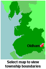
View maps of Oldham and places within its boundaries.
View a map of the boundaries of this town/parish.
You can see maps centred on OS grid reference SD936051 (Lat/Lon: 53.542472, -2.097954), Oldham which are provided by:
- OpenStreetMap
- Google Maps
- StreetMap (Current Ordnance Survey maps)
- Bing (was Multimap)
- Old Maps Online
- National Library of Scotland (Old Ordnance Survey maps)
- Vision of Britain (Click "Historical units & statistics" for administrative areas.)
- English Jurisdictions in 1851 (Unfortunately the LDS have removed the facility to enable us to specify a starting location, you will need to search yourself on their map.)
- Magic (Geographic information) (Click + on map if it doesn't show)
- GeoHack (Links to on-line maps and location specific services.)
- All places within the same township/parish shown on an Openstreetmap map.
- Nearby townships/parishes shown on an Openstreetmap map.
- Nearby places shown on an Openstreetmap map.
The Workhouse site has an interesting description of Oldham workhouse.
For probate purposes prior to 1858, Oldham was in the Archdeaconry of Chester, in the Diocese of Chester. The original Lancashire wills for the Archdeaconry of Chester are held at the Lancashire Record Office.
You can also see Family History Societies covering the nearby area, plotted on a map. This facility is being developed, and is awaiting societies to enter information about the places they cover.
Oldham Local Studies and Archives Library holds a full set of Burgess Roll and Electoral Registers going back to 1850 but the complete run covers the town of Oldham only. There are gaps during both World Wars when registers were not published.
Coverage of surrounding districts is good but there are gaps and Royton is not covered for the early 1920s. It is covered for 1851, 1871 - 1915 and 1973 to the present day. Lancashire Record Office in Preston hold registers from 1934 - 1946 but it is an incomplete run.