
Hide
Orrell
hide
Hide
hide
Hide
hide
Hide
Hide
"ORRELL and FORD, a township in Sefton parish, Lancashire; on the Leeds and Liverpool canal, 4½ miles N of Liverpool. Acres, 728. Real property, £2,753. Pop. in 1851, 279; in 1861, 358. Houses, 57. The increase of pop. arose from the extension of trade in Liverpool. Most of the land belongs to the Earl of Sefton. Ford Lodge and Hatton Hall are chief residences."
John Marius Wilson, Imperial Gazetteer of England and Wales (1870-72)
Hide
Details about the census records, and indexes for Orrell.
| Orrell Park Trinity Presbyterian Lancashire |
| Springwell Rd Presbyterian Church of Wales, Orrell |
The Register Office covering the Orrell area is Sefton South.
The National Gazetteer of Great Britain and Ireland - 1868
"ORELL AND FORD, a township in the parish of Sefton, hundred of West Derby, county Lancaster, 5 miles N. of Liverpool."
"FORD, a township united with Orrell, in the parish of Sefton, hundred of West Derby, county palatine of Lancaster, 6 miles N. of Liverpool. It is near the river Alt and the Leeds canal."
- Ask for a calculation of the distance from Orrell to another place.
In 1835 Orrell was a township in the parish of Sefton.
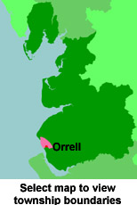
View maps of Orrell and places within its boundaries.
View a map of the boundaries of this town/parish.
You can see maps centred on OS grid reference SJ344980 (Lat/Lon: 53.4743, -2.989204), Orrell which are provided by:
- OpenStreetMap
- Google Maps
- StreetMap (Current Ordnance Survey maps)
- Bing (was Multimap)
- Old Maps Online
- National Library of Scotland (Old Ordnance Survey maps)
- Vision of Britain (Click "Historical units & statistics" for administrative areas.)
- English Jurisdictions in 1851 (Unfortunately the LDS have removed the facility to enable us to specify a starting location, you will need to search yourself on their map.)
- Magic (Geographic information) (Click + on map if it doesn't show)
- GeoHack (Links to on-line maps and location specific services.)
- All places within the same township/parish shown on an Openstreetmap map.
- Nearby townships/parishes shown on an Openstreetmap map.
- Nearby places shown on an Openstreetmap map.
For probate purposes prior to 1858, Orrell was in the Archdeaconry of Chester, in the Diocese of Chester. The original Lancashire wills for the Archdeaconry of Chester are held at the Lancashire Record Office.
You can also see Family History Societies covering the nearby area, plotted on a map. This facility is being developed, and is awaiting societies to enter information about the places they cover.