
Hide
Out Rawcliffe
hide
Hide
hide
Hide
hide
Hide
Hide
RAWCLIFFE (Out), a township-chapelry in St. Michael-on-Wyre parish, Lancashire; on the river Wyre, 4 miles E by N of Poulton r. station, and 5½ W S W of Garstang. Post-town, Great Eccleston, under Garstang. Acres, 4,340, of which 180 are water. Real property, £5,591. Pop., 771. Houses, 135. The manor belongs to the representatives of the late R. W. France, Esq. The living is a p. curacy in the diocese of Manchester. Value, £100.* Patron, the Vicar of St. Michael-on-Wyre. The church was built in 1838, and is in the Norman style. There are a Wesleyan chapel and a national school.
John Marius Wilson, Imperial Gazetteer of England and Wales (1870-72)
Hide
Local studies information is held at Garstang library.
Details about the census records, and indexes for Out Rawcliffe.
The Register Office covering the Out Rawcliffe area is Lancaster.
The National Gazetteer of Great Britain and Ireland - 1868
"OUT RAWCLIFFE, a township and chapelry in the parish of St. Michael-on-Wyre, county Lancaster, 6 miles S.W. of Garstang, its post town, and 4½ of Poulton-le-Fylde. The township, which is much scattered, is situated on the river Wyre, and is wholly agricultural. The living is a perpetual curacy in the diocese of Manchester, value £105, in the patronage of the Vicar of St. Michael-on-Wyre. The church, dedicated to St. John, was erected in 1838, on a site of land presented by F. R. W. Ffrance, Esq., by whom its expense was most liberally defrayed. It was designed after the ruins of Glastonbury abbey. There is a National school for both sexes. The Wesleyans have a place of worship. R. W. Ffrance, Esq., is lord of the manor and principal landowner.
- Ask for a calculation of the distance from Out Rawcliffe to another place.
In 1835 Out Rawcliffe was a township in the parish of St. Michaels on Wyre.
View maps of Out Rawcliffe and places within its boundaries.
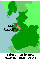
View a map of the boundaries of this town/parish.
You can see maps centred on OS grid reference SD402429 (Lat/Lon: 53.878406, -2.91113), Out Rawcliffe which are provided by:
- OpenStreetMap
- Google Maps
- StreetMap (Current Ordnance Survey maps)
- Bing (was Multimap)
- Old Maps Online
- National Library of Scotland (Old Ordnance Survey maps)
- Vision of Britain (Click "Historical units & statistics" for administrative areas.)
- English Jurisdictions in 1851 (Unfortunately the LDS have removed the facility to enable us to specify a starting location, you will need to search yourself on their map.)
- Magic (Geographic information) (Click + on map if it doesn't show)
- GeoHack (Links to on-line maps and location specific services.)
- All places within the same township/parish shown on an Openstreetmap map.
- Nearby townships/parishes shown on an Openstreetmap map.
- Nearby places shown on an Openstreetmap map.
For probate purposes prior to 1858, Out Rawcliffe was in the Archdeaconry of Richmond, in the Diocese of Chester. The original Lancashire wills for the Archdeaconry of Richmond are held at the Lancashire Record Office.
You can also see Family History Societies covering the nearby area, plotted on a map. This facility is being developed, and is awaiting societies to enter information about the places they cover.