
Hide
St Lawrence, Morecambe, Church of England
hide
Hide
Hide
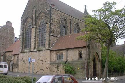
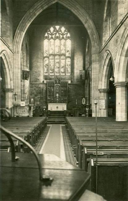
St Lawrence,
Edward St,
Morecambe
Lancashire
Edward St,
Morecambe
Lancashire
Hide
It was founded in 1877 and closed in 1981. It was fromed from the parish of Holy Trinity and upon closure it was again joined with Holy Trinity.
Whilst every effort has been made to record exact details of record office and library holdings you are recommended to check with them before visiting to ensure that they do hold the records and years you wish to examine. Similarly check with transcript publishers to ensure they cover the records and years you require before making a purchase.
These are now held at Holy Trinity.
It was located at SD4327264305 (Lat/Lon 54.071537, -2.868386). You can see this on maps provided by:
- OpenStreetMap
- Google Maps
- StreetMap (Current Ordnance Survey maps)
- Bing (was Multimap)
- Old Maps Online
- National Library of Scotland (Old Ordnance Survey maps)
- Vision of Britain (Click "Historical units & statistics" for administrative areas.)
- English Jurisdictions in 1851 (Unfortunately the LDS have removed the facility to enable us to specify a starting location, you will need to search yourself on their map.)
- Magic (Geographic information) (Click + on map if it doesn't show)
- GeoHack (Links to on-line maps and location specific services.)