
Hide
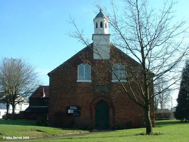
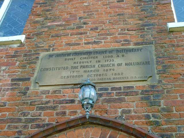
St Helen, Hollinfare, Church of England
hide
Hide

Photograph supplied by & Copyright of Mike Berrell
Hide
St Helen,
School Lane,
Hollinfare
Lancashire
Hide
Baptisms
1654-1837
Transcript of baptisms 1654-1837 by the Lancashire Parish Register Society - Volume 120
1753-1870
Copy of Bishop's Transcript of baptisms 1753-1870 held by Lancashire Archives - DRL 2/460-461 483-485
Marriages
1705-1744
Transcript of marriages 1705-1744 by the Lancashire Parish Register Society - Volume 120
Burials
1709-1837
Transcript of burials 1709-1837 by the Lancashire Parish Register Society - Volume 120
1753-1870
Copy of Bishop's Transcript of burials 1753-1870 held by Lancashire Archives - DRL 2/460-461 483-485
It is located at SJ6972791135 (Lat/Lon 53.416144, -2.456941). You can see this on maps provided by:
- OpenStreetMap
- Google Maps
- StreetMap (Current Ordnance Survey maps)
- Bing (was Multimap)
- Old Maps Online
- National Library of Scotland (Old Ordnance Survey maps)
- Vision of Britain (Click "Historical units & statistics" for administrative areas.)
- English Jurisdictions in 1851 (Unfortunately the LDS have removed the facility to enable us to specify a starting location, you will need to search yourself on their map.)
- Magic (Geographic information) (Click + on map if it doesn't show)
- GeoHack (Links to on-line maps and location specific services.)