
Hide
Stretford
hide
Hide
hide
Hide
hide
Hide
Hide
STRETFORD, a township, a chapelry, and a sub-district, on the S border of Lancashire. The township lies on the Manchester and Altrincham railway, 4 miles SW of Manchester; is in Manchester parish; includes Old Trafford chapelry; contains many handsome villa residences, a public hall, a temperance institute, the Manchester botanic garden, the asylum for the blind, the school for the deaf and dumb, two churches, five dissenting chapels, a Roman Catholic chapel of 1864, and a large national school; and has a r. station with telegraph, and a post-office, designated Stretford, Lancashire. Acres, 3,140. Real property, £42,938; of which £500 are in gasworks. Pop. in 1851, 4,998; in 1861, 8,757. Houses, 1,668. The chapelry was constituted in 1854. Pop., 3,882. Houses, 791. The living is a rectory in the diocese of Manchester. Value, £405.* Patrons, the Dean and Chapter of M. The church was rebuilt in 1841. The sub-district comprises S. township and Flixton parish, and is in Barton-upon-Irwell district. Acres, 5,689. Pop., 10,807. Houses, 2,077.
John Marius Wilson, Imperial Gazetteer of England and Wales (1870-72)
Hide
Local studies information is held at Trafford Local studies library.
| Chester Road, Stretford, Congregational |
| Lime Rd Cemetery, Stretford |
Details about the census records, and indexes for Stretford.
The Register Office covering the Stretford area is Trafford.
The National Gazetteer of Great Britain and Ireland - 1868
"STRETFORD, a chapelry and township in the parish of Manchester, hundred of Salford, county Lancaster, 3½ miles S.W. of Manchester, its post town. It is a station on the Manchester, South Junction, and Altrincham railway. The village is situated on the Bridgwater canal, near the river Mersey, where the Roman way to Chester crossed. There is a large paper mill and a mart for pigs for supply of the Manchester market. The living is a rectory in the diocese of Manchester, value £150, in the patronage of the dean and chapter. The church is modern. The parochial charities, about £100 per annum, go to Hinde's school. Henshaw's blind asylum and a deaf and dumb school are in this township. The Independents, Wesleyans, and Primitive Methodists have chapels."
- Ask for a calculation of the distance from Stretford to another place.
In 1835 Stretford was a township in the parish of Manchester.
View maps of Stretford and places within its boundaries.
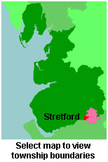
View a map of the boundaries of this town/parish.
You can see maps centred on OS grid reference SJ806951 (Lat/Lon: 53.452255, -2.293745), Stretford which are provided by:
- OpenStreetMap
- Google Maps
- StreetMap (Current Ordnance Survey maps)
- Bing (was Multimap)
- Old Maps Online
- National Library of Scotland (Old Ordnance Survey maps)
- Vision of Britain (Click "Historical units & statistics" for administrative areas.)
- English Jurisdictions in 1851 (Unfortunately the LDS have removed the facility to enable us to specify a starting location, you will need to search yourself on their map.)
- Magic (Geographic information) (Click + on map if it doesn't show)
- GeoHack (Links to on-line maps and location specific services.)
- All places within the same township/parish shown on an Openstreetmap map.
- Nearby townships/parishes shown on an Openstreetmap map.
- Nearby places shown on an Openstreetmap map.
For probate purposes prior to 1858, Stretford was in the Archdeaconry of Chester, in the Diocese of Chester. The original Lancashire wills for the Archdeaconry of Chester are held at the Lancashire Record Office.
You can also see Family History Societies covering the nearby area, plotted on a map. This facility is being developed, and is awaiting societies to enter information about the places they cover.