
Hide
Thornton
hide
Hide
hide
Hide
hide
Hide
Hide
THORNTON, a chapelry and a township in Poulton-le-Fylde parish, Lancashire. The chapelry adjoins Fleetwood town and r. station, and has a post-office under Preston. Pop., 826. The living is a p. curacy in the diocese of Manchester. Value, £105. Patrons, Trustees. The church was built in 1835. There are a Wesleyan chapel and a free school. The township includes Fleetwood, and is noticed in our article on that town.
John Marius Wilson, Imperial Gazetteer of England and Wales (1870-72)
Hide
Local studies information is held at Poulton library.
Details about the census records, and indexes for Thornton.
| All Saints, Anchorsholme, Church of England |
| Christ Church, Thornton, Church of England |
| St Andrew Church of England, Cleveleys |
| St John the Evangelist, Little Thornton, Church of England |
| Rossall Rd United Reformed, Thornton |
| Cleveleys Park Methodist, Cleveleys |
| Fleetwood Rd, Thornton, Primitive Methodist |
| North Drive, Anchorsholme, Methodist |
| Wignall Memorial, Thornton, Wesleyan Methodist |
| Sacred Heart, Thornton, Roman Catholic |
| St John Southworth Roman Catholic, Cleveleys |
| St Nicholas Owen, Thornton, Roman Catholic |
| St Teresa Roman Catholic, Cleveleys |
The Register Office covering the Thornton area is Blackpool & Fylde.
The National Gazetteer of Great Britain and Ireland - 1868
"THORNTON, a township in the parish of Poulton-le-Fylde, hundred of Amounderness, county Lancaster, 2 miles N.E. of Poulton, its post town and railway station. The township, which is extensive, is situated oil the Preston railway and the river Wyre, and includes the new town and port of Fleetwood [which see]. The lands on which the town is built were, prior to 1836, one wild tract of rabbit warren, but through the enterprise of Sir Peter Hesketh Fleetwood, Bart., have been transformed into a populous and thriving district, with harbour and docks, the plan of which was laid down by Decimus Burton, of London, architect. The township is bounded on the N. by Lancaster and Morecombe Bay, and on the E. and S. by the river Wyre. The living is a perpetual curacy in the diocese of Manchester, value £105, in the patronage of trustees. The church has a stained E. window. Rossall is now converted into a collegiate school."
- Ask for a calculation of the distance from Thornton to another place.
In 1835 Thornton was a township in the parish of Poulton le Fylde.
View maps of Thornton and places within its boundaries.
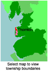
View a map of the boundaries of this town/parish.
You can see maps centred on OS grid reference SD337426 (Lat/Lon: 53.875183, -3.01019), Thornton which are provided by:
- OpenStreetMap
- Google Maps
- StreetMap (Current Ordnance Survey maps)
- Bing (was Multimap)
- Old Maps Online
- National Library of Scotland (Old Ordnance Survey maps)
- Vision of Britain (Click "Historical units & statistics" for administrative areas.)
- English Jurisdictions in 1851 (Unfortunately the LDS have removed the facility to enable us to specify a starting location, you will need to search yourself on their map.)
- Magic (Geographic information) (Click + on map if it doesn't show)
- GeoHack (Links to on-line maps and location specific services.)
- All places within the same township/parish shown on an Openstreetmap map.
- Nearby townships/parishes shown on an Openstreetmap map.
- Nearby places shown on an Openstreetmap map.
For probate purposes prior to 1858, Thornton was in the Archdeaconry of Richmond, in the Diocese of Chester. The original Lancashire wills for the Archdeaconry of Richmond are held at the Lancashire Record Office.
You can also see Family History Societies covering the nearby area, plotted on a map. This facility is being developed, and is awaiting societies to enter information about the places they cover.