
Hide
Tonge
hide
Hide
hide
Hide
hide
Hide
Hide
TONGE, a township and a chapelry in Prestwich parish, Lancashire. The township lies around Middleton r. station, adjacent to the SE side of Middleton. Post town, Middleton, under Manchester. Acres, 367. Real property, £10,774; of which £300 are in mines, £39 in ironworks, and £1,116 in gasworks. Pop. in 1851, 3,831; in 1861, 4,606. Houses, 953. The increase of pop. arose from extension of the cotton trade, and from erection of silk manufactories. The property is subdivided. The chapelry includes Alkrington township, and was constituted in 1835. Pop., 5,029. Houses, 1,030. The living is a p. curacy in the diocese of Manchester. Value, £300.* Patron, the Rector of Prestwich. The church was built in 1839.
John Marius Wilson, Imperial Gazetteer of England and Wales (1870-72)
Hide
Details about the census records, and indexes for Tonge.
| Tonge, Primitive Methodist |
The Register Office covering the Tonge area is Rochdale.
The National Gazetteer of Great Britain and Ireland - 1868
"TONGE, a township in the parish of Prestwich, hundred of Salford, county Lancaster, 1 mile S.E. of Middleton, its post town. It is a station on the Manchester and Leeds railway. Many of the inhabitants are employed in the silk mills. The village, with the hamlet of Alkrington, forms an ecclesiastical district, containing in 1861 a population of 5,029. The living is a perpetual curacy in the diocese of Manchester, value £150, in the patronage of the Rector of Prestwich. The church, dedicated to St. Michael, was built by aid of the Parliamentary Commissioners in 1839."
- Ask for a calculation of the distance from Tonge to another place.
In 1835 Tonge was a township in the parish of Oldham.
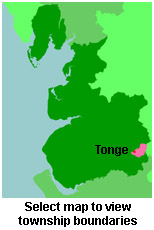
View maps of Tonge and places within its boundaries.
View a map of the boundaries of this town/parish.
You can see maps centred on OS grid reference SD882056 (Lat/Lon: 53.54681, -2.178898), Tonge which are provided by:
- OpenStreetMap
- Google Maps
- StreetMap (Current Ordnance Survey maps)
- Bing (was Multimap)
- Old Maps Online
- National Library of Scotland (Old Ordnance Survey maps)
- Vision of Britain (Click "Historical units & statistics" for administrative areas.)
- English Jurisdictions in 1851 (Unfortunately the LDS have removed the facility to enable us to specify a starting location, you will need to search yourself on their map.)
- Magic (Geographic information) (Click + on map if it doesn't show)
- GeoHack (Links to on-line maps and location specific services.)
- All places within the same township/parish shown on an Openstreetmap map.
- Nearby townships/parishes shown on an Openstreetmap map.
- Nearby places shown on an Openstreetmap map.
For probate purposes prior to 1858, Tonge was in the Archdeaconry of Chester, in the Diocese of Chester. The original Lancashire wills for the Archdeaconry of Chester are held at the Lancashire Record Office.
You can also see Family History Societies covering the nearby area, plotted on a map. This facility is being developed, and is awaiting societies to enter information about the places they cover.