
Hide
St Ursula Roman Catholic, Cotton Tree
hide
Hide
Hide
St Ursula,
Winewall Lane,
Cotton Tree
Lancashire
Winewall Lane,
Cotton Tree
Lancashire
Hide
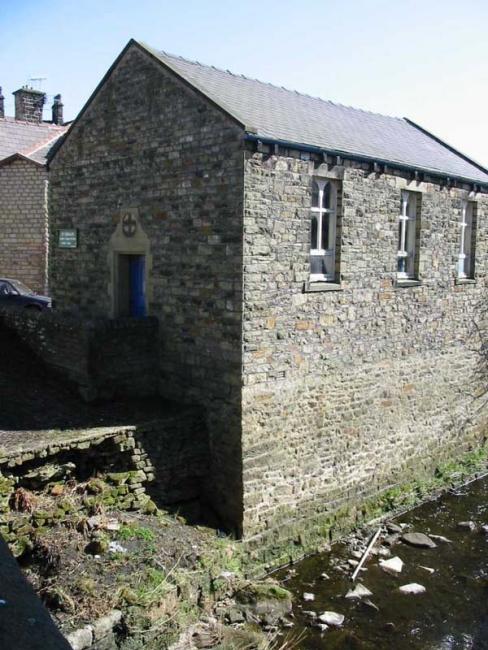
A chapel was opened at Cotton Tree in 1912 as a chapel-od-ease to The Sacred Heart, Colne. It never became independent and was closed in 2003.
No separate registers.
This site provides historical information about churches, other places of worship and cemeteries. It has no connection with the churches etc. themselves.
It was located at SD9085840062 (Lat/Lon 53.856702, -2.14047). You can see this on maps provided by:
- OpenStreetMap
- Google Maps
- StreetMap (Current Ordnance Survey maps)
- Bing (was Multimap)
- Old Maps Online
- National Library of Scotland (Old Ordnance Survey maps)
- Vision of Britain (Click "Historical units & statistics" for administrative areas.)
- English Jurisdictions in 1851 (Unfortunately the LDS have removed the facility to enable us to specify a starting location, you will need to search yourself on their map.)
- Magic (Geographic information) (Click + on map if it doesn't show)
- GeoHack (Links to on-line maps and location specific services.)