
Hide
Walmersley
hide
Hide
hide
Hide
hide
Hide
Hide
WALMERSLEY, a village, a township, a chapelry, and a sub-district, in Bury parish and district, Lancashire. The village stands near Summerseat r. station, 2¼ miles N of Bury; carries on manufactures similar to those of Bury; and has a post-office under Bury, Lancashire. The township includes Shuttleworth, 2½ miles to the N; and bears the name of W.-cum-Shuttleworth. Acres, 5,056. Real property, £20,417; of which £400 are in mines, £228 in quarries, and £163 in gasworks. Pop. in 1851, 4,802; in 1861, 5,298. Houses, 1,003. The chapelry excludes Shuttleworth, and was constituted in 1843. Pop. in 1861, 3,269. Houses, 628. The living is a vicarage in the diocese of Manchester. Value, £130. Patrons, Trustees. The church is good; and there are Independent and Wesleyan chapels, a national school, and charities £23. The sub-district excludes part of W. township, but includes small parts of three other townships. Pop. in 1861, 5,062. Houses, 964.
John Marius Wilson, Imperial Gazetteer of England and Wales (1870-72)
Hide
Local studies information is held at Bury library.
| Park Independent, Walmersley |
Details about the census records, and indexes for Walmersley.
| Spring St, Shuttleworth, Baptist |
| Park Independent, Walmersley |
The Register Office covering the Walmersley area is Bury.
The National Gazetteer of Great Britain and Ireland - 1868
"WALMERSLEY-CUM-SHUTTLEWORTH, a township in the parish of Bury, hundred of Salford, county Lancaster, 24 miles N.E. of Bury, its post town. It is situated on the river Irwell, and has a railway station at Summerseat. Many of the inhabitants are employed in the cotton spinning mills. In the neighbourhood are the ruins of a beacon tower, said to have been erected in Elizabeth's time, and nearly opposite, on an eminence, is the seat of the Grants, the eminent manufacturers. The living is a perpetual curacy in the diocese of Manchester, value £130, in the patronage of trustees. The parochial charities produce about £23 per annum, of which £3 go to a school. There is a National school. The Independents and Wesleyans have each a chapel, and The latter a day-school."
"SHUTTLEWORTH, a township in the parish of Bury, hundred of Salford, county Lancaster, 4 miles N. of Bury, its post town, and the same distance from Haslingden. It is a station on the East Lancashire railway. The village is situated on the high road from Rawtenstall to Bury, near the river Irwell. The district of Shuttleworth, which is extensive, was formed into a parish in 1845, and comprises the township of its own name, and part of that of Walmersley. It gives name to the Shuttleworths of Gawthorp, at which place they settled in Richard II.'s time. In the vicinity are cotton, woollen, and paper mills; also collieries, stone quarries, and bleach works, which give employment to a large number of the inhabitants. The soil is of a heavy character, upon a rocky subsoil. The living is a perpetual curacy in the diocese of Manchester, value £160, in the patronage of the crown and bishop alternately. The church, dedicated to St. John in the Wilderness, was erected in 1847, at an expense of £2,000. There are National schools for both sexes. The Independents and Wesleyans have each a place of worship, in which Sunday-schools are held. There are also a library and reading rooms. Nearly in the centre of the parish stands Grant's Tower, and on the opposite side of the valley is a monument of Sir Robert Peel. The Edenfield and Bury coaches pass through the village daily."
"SUMMER SEAT, a village in the township of Elton, parish of Bury, county Lancaster, 1 mile N.W. of Bury. It is a station on the East Lancashire and Yorkshire railway."
- Ask for a calculation of the distance from Walmersley to another place.
In 1835 Walmersley and Shuttleworth was a township in the parish of Bury.
View maps of Walmersley and places within its boundaries.
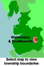
View a map of the boundaries of this town/parish.
You can see maps centred on OS grid reference SD814163 (Lat/Lon: 53.642443, -2.28292), Walmersley which are provided by:
- OpenStreetMap
- Google Maps
- StreetMap (Current Ordnance Survey maps)
- Bing (was Multimap)
- Old Maps Online
- National Library of Scotland (Old Ordnance Survey maps)
- Vision of Britain (Click "Historical units & statistics" for administrative areas.)
- English Jurisdictions in 1851 (Unfortunately the LDS have removed the facility to enable us to specify a starting location, you will need to search yourself on their map.)
- Magic (Geographic information) (Click + on map if it doesn't show)
- GeoHack (Links to on-line maps and location specific services.)
- All places within the same township/parish shown on an Openstreetmap map.
- Nearby townships/parishes shown on an Openstreetmap map.
- Nearby places shown on an Openstreetmap map.
For probate purposes prior to 1858, Walmersley was in the Archdeaconry of Chester, in the Diocese of Chester. The original Lancashire wills for the Archdeaconry of Chester are held at the Lancashire Record Office.
You can also see Family History Societies covering the nearby area, plotted on a map. This facility is being developed, and is awaiting societies to enter information about the places they cover.