
Hide
Benington
hide
Hide
hide
Hide
hide
Hide
Hide
hide
Hide
Hide
The Library at Boston will prove useful in your research.
John BLAKESTONE has a photograph of All Saints well-tended churchyard on Geo-graph, taken in September, 2011.
- The parish was the heart of the Benington sub-district of the Boston Registration District.
- Check our Census Resource page for county-wide resources.
- The table below gives census piece numbers, where known:
| Census Year | Piece No. |
|---|---|
| 1861 | R.G. 9 / 2333 |
| 1871 | R.G. 10 / 3336 - 3337 |
| 1891 | R.G. 12 / 2571 |
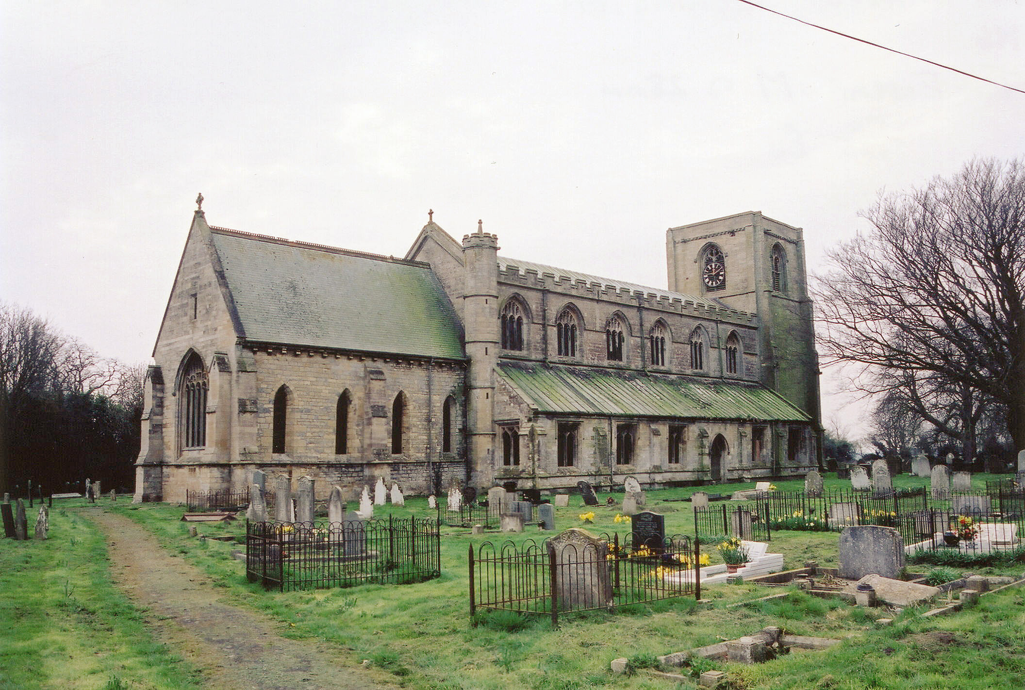
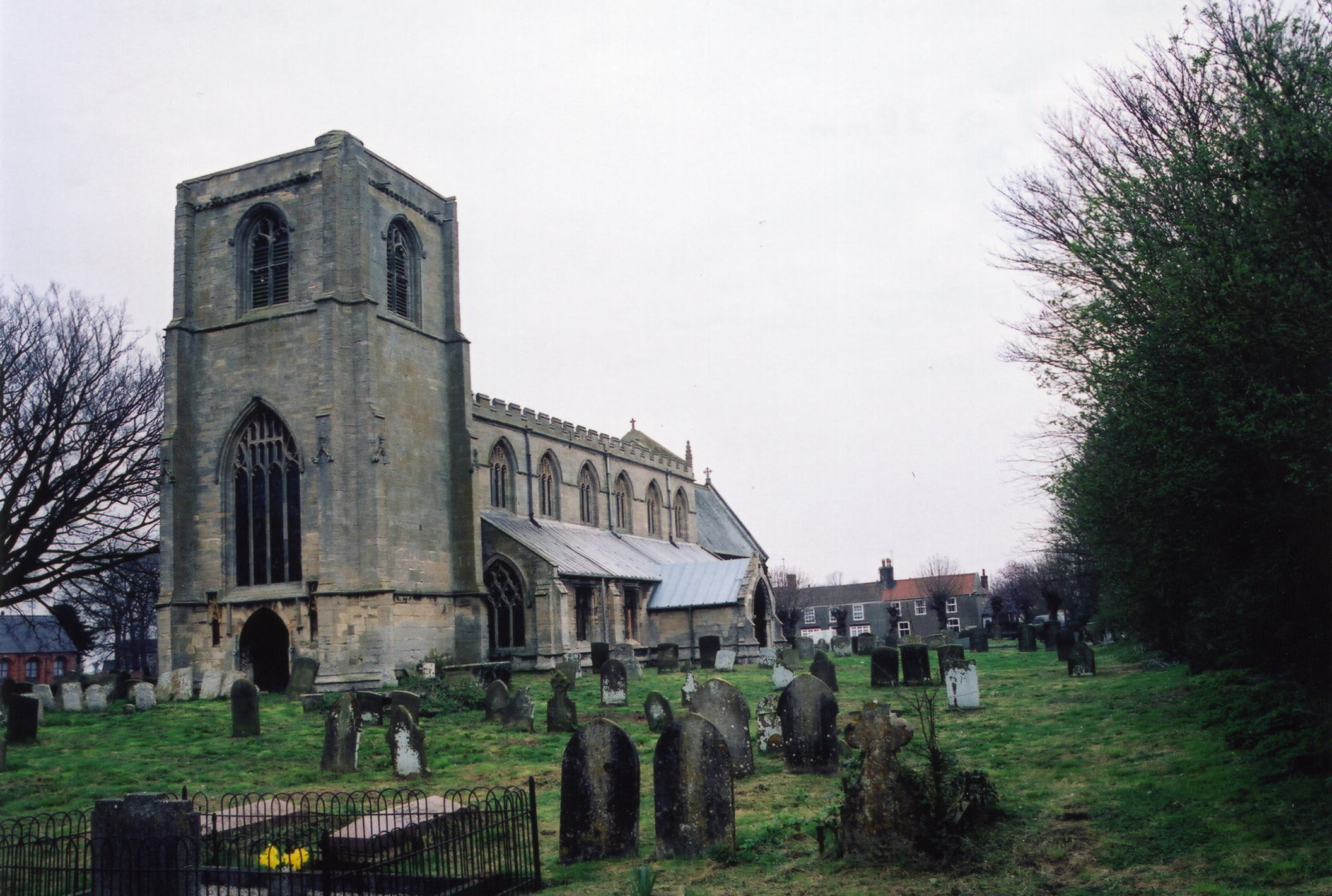
- The Anglican parish church is dedicated to All Saints.
- The church is built of stone in the Early English style and dated to the 13th Century.
- The church seats 375 people.
- The church was restored in 1873.
- The church was declared redundant by the Diocese of Lincoln in February, 2003. There are current plans to turn it into a community centre (2015).
- Geoff PICK has a photograph of All Saints Church, all boarded up on Geo-graph, taken in August, 2003.
- Here are three photos of the church, taken by Ron COLE (who retains the copyright):

- The Anglican parish register dates from 1567.
- The LFHS has published several indexes for the Holland East Deanery to make your search easier.
- The Primitive Methodists built a chapel here in 1838. For more on researching these chapel records, see our non-conformist religions page.
- Check our Church Records page for county-wide resources.
- The parish was in the Benington sub-district of the Boston Registration District.
- Check our Civil Registration page for sources and background on Civil Registration which began in July, 1837.
Benington is both a village and a parish which abuts the North Sea by The Wash. The parish lies about 5 miles northeast of Boston. Leverton parish is just to the north, Butterwick parish to the west and south and the North Sea to the east. The parish covers almost 2,800 acres and includes the hamlets of Sea Bank and West End.
If you are planning a visit:
- Take the A52 north out of Boston. It passes through Benington village.
- J. THOMAS has captured a photograph of the Village Sign on Geo-graph, taken in July, 2020.
- See our Touring page for additional resources.
- Ask for a calculation of the distance from Benington to another place.
Should you need to ask the locals about local history, stop in at the Admiral Nelson Public House. Neil THEASBY has a photograph of the Admiral Nelson in the heart of the village on Geo-graph, taken in September, 2020.
- The national grid reference is TF 3946.
- You'll want an Ordnance Survey Explorer #261 map, which has a scale of 2.5 inches to the mile.
- See our Maps page for additional resources.
You can see maps centred on OS grid reference TF397466 (Lat/Lon: 52.998509, 0.080189), Benington which are provided by:
- OpenStreetMap
- Google Maps
- StreetMap (Current Ordnance Survey maps)
- Bing (was Multimap)
- Old Maps Online
- National Library of Scotland (Old Ordnance Survey maps)
- Vision of Britain (Click "Historical units & statistics" for administrative areas.)
- English Jurisdictions in 1851 (Unfortunately the LDS have removed the facility to enable us to specify a starting location, you will need to search yourself on their map.)
- Magic (Geographic information) (Click + on map if it doesn't show)
- GeoHack (Links to on-line maps and location specific services.)
- All places within the same township/parish shown on an Openstreetmap map.
- Nearby townships/parishes shown on an Openstreetmap map.
- Nearby places shown on an Openstreetmap map.
- There are photographs of Benington War Memorials at Memorials Lincs. Note that some of the findings for names listed on the memorial differ from those presented by Eric WALTER, below. I have not resolved those discrepancies.
Eric WALTER provides this list of names from the war memorial.
Benington War Memorial
| Cemetery | Died | Surname | Given names | Div. or Btn. | Branch | Note |
|---|---|---|---|---|---|---|
| Thiepval Mem. | 11-Nov-16 | Bailey | Robert | 8 | Norfolk | |
| Vimy Mem. | 15-Aug-17 | Bland | George William | 7 | Canada Inf. | |
| Benington All Saints | 27-Nov-16 | Bolland | Arthur | 7 | DOW | |
| Berles Position MC | 09-Aug-16 | Bolland | Joseph | 4 | Lincs | |
| Menin Gate | 30-Jul-17 | Crawford | Charles Richard | 8 | W Surrey | |
| Thiepval Mem. | 30-Sep-16 | Crowder | Frederick WIlliam | 1 | Lincs | |
| Thiepval Mem. | 15-Sep-16 | Crowder | Harry | Coldstream | ||
| Chatham Naval Mem. | 22-Sep-14 | Harwood | William | HMS Cressy | ||
| South Russia | 24-Nov-17 | Harwood | Harry | 7 | N Staffs | |
| Ploegsteert Mem. | 15-Apr-18 | Harwood | George | 5 | Lincs | |
| Niederzwehren Cty. | 03-Jun-18 | Needham | Fred | 1 | W Surrey | |
| Bedford House Cty Enc. | 18-Jun-15 | Sharp | Albert Cornelius | 8 | Lincs | |
| Cement House Cty. | 23-Oct-17 | Tether | Charles S | 10 | Lincs | |
| Thiepval Mem. | 23-Oct-16 | Thompson | Joseph | 2 | Lincs | |
| Benington All Saints | 16-Feb-20 | Toynton | Robert Harold | 67 | RE - Signals | |
| Tincourt NBC | 30-Dec-17 | Ward | Joseph Richard | 9 | Leics | |
| Roeux BC | 20-Apr-17 | Woods | Herbert | 10 | Lincs |
- The name Benington is from the Old English Beonna+ing+tun, meaning "farmstead of a man named Beonna". In the 12th Century, the name is found as Benigtun. Some old sources give the name as Benningtone or Benninctun
A. D. Mills, "A Dictionary of English Place-Names," Oxford University Press, 1991.
- This place was an ancient parish in Lincolnshire and became a modern Civil Parish when those were established.
- The parish was in the ancient Skirbeck Wapentake in the parts of Holland.
- A December, 1880, Local Government Board Order transferred a detached part of this parish, with 76 inhabitants, to Leake.
- You may contact the local Parish Council regarding civic and political matters, but they are NOT able to help you with family history lookups. At last check, in 2021, the council website was still under construction.
- J. THOMAS has a photograph of the Village Hall on Geo-graph, taken in July, 2020.
- For today's district governance, visit the local Boston Borough Council.
- Bastardy cases would be heard in the Kirton and Skirbeck petty session hearings.
- The Comman Lands were enclosed here in 1815.
- The parish had four bedehouses built sometime before 1841.
- As a result of the 1834 Poor Law Amendment Act, this parish became part of the Boston Poor Law Union.
- The village had a Public Elementary School built prior to 1841. The school was founded in 1704 by Richard COWELL, who left a building in his estate which was converted into a schoolroom.
- See our Schools page for more information on researching school records.