
Hide
Bitchfield
hide
Hide
hide
Hide
hide
Hide
Hide
hide
Hide
Hide
The Library at Grantham will prove useful in your research.
J. HANNAN-BRIGGS has a photograph of St. Mary Magdalene and the churchyard on Geo-graph, taken in March, 2012.
- The parish was in the Colsterworth sub-district of the Grantham Registration District.
- In 1890, as a result of the Poor Law Union reorganisation, the parish was placed in the Grantham South sub-district of the Grantham Registration District.
- Check our Census Resource page for county-wide resources.
- The table below gives census piece numbers, where known:
| Census Year | Piece No. |
|---|---|
| 1841 | H.O. 107 / 615 |
| 1851 | H.O. 107 / 2105 |
| 1861 | R.G. 9 / 2347 |
| 1871 | R.G. 10 / 3355 |
| 1891 | R.G. 12 / 2582 |
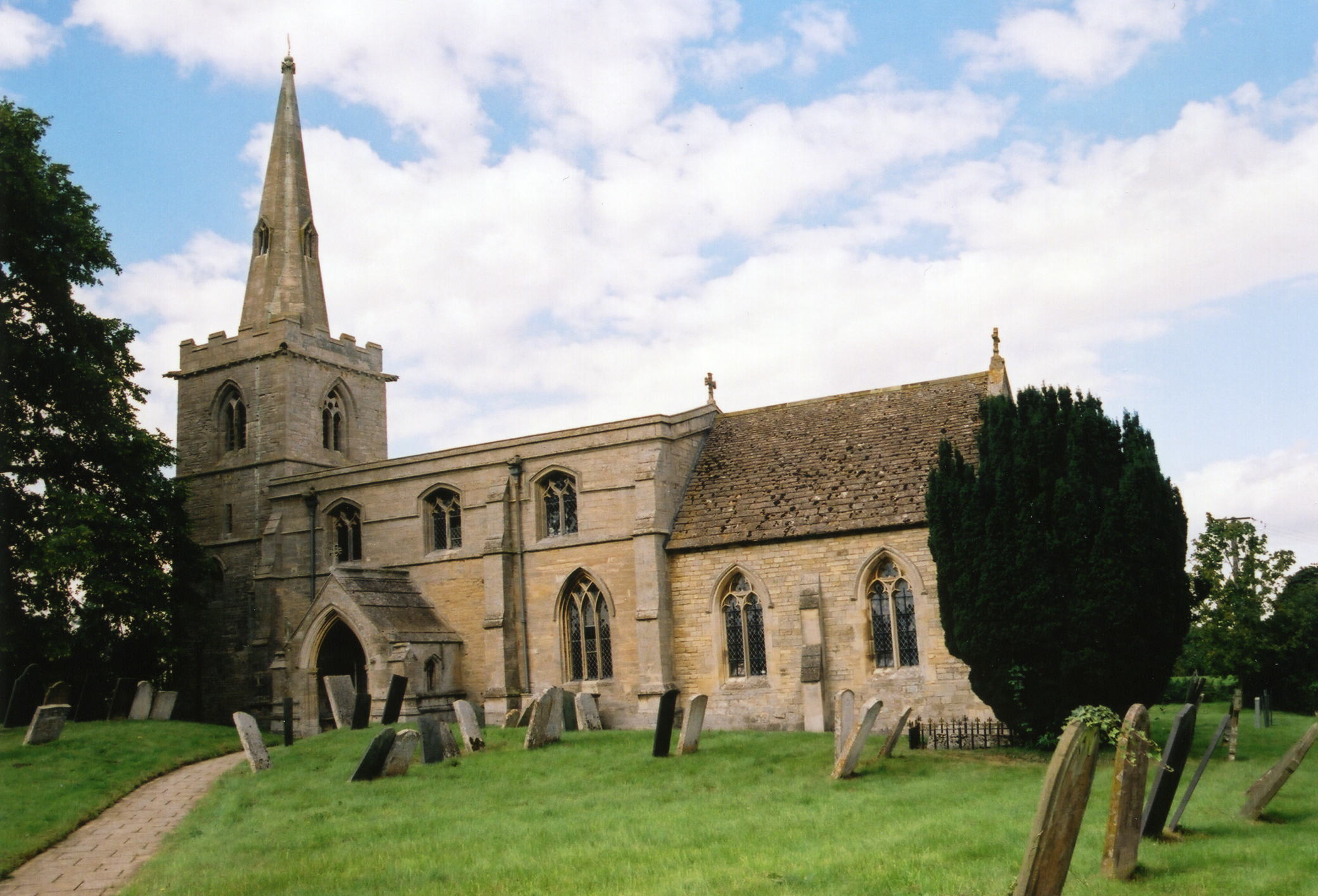
- The Anglican parish church was dedicated to Saint Mary Magdalen.
- The 1086 Domesday Book tells us that there was a church here before the Conquest.
- The church was built in the 10th century and enlarged in the 12th century.
- The church was restored in 1873.
- The church spire was struck by lightning in 1947, and the upper half repaired early the next year.
- The church seats only about 100 people.
- There is a photograph of St. Mary Magdalen's Church on the Wendy PARKINSON web site under "Still more Lincolnshire".
- Richard CROFT has a photograph of St. Mary's Church on Geo-graph, taken in August, 2006.
- Here is a photograph St. Mary's Church supplied by Ron COLE (who retains the copyright):
- The Anglican parish register dates from 1674.
- The Lincolnshire FHS has published several marriage indexes and a burial index for the Beltisloe Deanery to make your search easier.
- Check our Church Records page for county-wide resources.
- The parish was in the Colsterworth sub-district of the Grantham Registration District.
- In 1890, as a result of the Poor Law Union reorganisation, the parish was placed in the Grantham South sub-district of the Grantham Registration District.
- Check our Civil Registration page for sources and background on Civil Registration which started in July, 1837.
Bitchfield is a village and a parish on the River Glen, 3 miles north of Corby and 8 miles southeast of Grantham. The parish covered 1,357 acres.
If you are planning a visit, see:
- By automobile, take the A52 trunk road east out of Grantham and turn right (south) onto the B1176 arterial road. Bitchfield is about six miles along that road.
- The West Glen River separates Lower Bitchfield (and the church) from Bitchfield village in its passage south.
- Robert HARVEY has a photograph of the West Glen River on Geo-graph, taken in March, 2019, from Dark Lane.
- See our touring page for visitor services.
- Ask for a calculation of the distance from Bitchfield to another place.
The Crown Inn Public House is a Grade II structure with English Heritage. It sits on the Main Road west of the village center. It was built in the 17th century and modernised in the 19th century.
- Bitchfield House is a relatively modern manor house. In 1882 it was occupied by Mr. Joseph GRUMMITT.
- See our Maps page for additional resources.
You can see maps centred on OS grid reference SK988287 (Lat/Lon: 52.846751, -0.534431), Bitchfield which are provided by:
- OpenStreetMap
- Google Maps
- StreetMap (Current Ordnance Survey maps)
- Bing (was Multimap)
- Old Maps Online
- National Library of Scotland (Old Ordnance Survey maps)
- Vision of Britain (Click "Historical units & statistics" for administrative areas.)
- English Jurisdictions in 1851 (Unfortunately the LDS have removed the facility to enable us to specify a starting location, you will need to search yourself on their map.)
- Magic (Geographic information) (Click + on map if it doesn't show)
- GeoHack (Links to on-line maps and location specific services.)
- All places within the same township/parish shown on an Openstreetmap map.
- Nearby townships/parishes shown on an Openstreetmap map.
- Nearby places shown on an Openstreetmap map.
- The name Bitchfield is from the Old English Bill's+feld, or "Bill's field". In the 1086 Domesday Book the village is given as Billesfelt.
["A Dictionary of English Place-Names," A. D. Mills, Oxford University Press, 1991]
- This place was an ancient parish in Lincolnshire and became a modern Civil Parish when those were established.
- The parish was in the ancient Beltisloe Wapentake in the South Kesteven district and in the parts of Kesteven.
- Robert HARVEY has a photograph of Bitchfield Village Hall on Geo-grah, taken in May, 2015.
- Bitchfield was abolished as a Civil Parish in 1931 and the land incorporated into surrounding parishes.
- For today's district governance, contact the South Kesteven District Council.
- Bastardy cases would be heard in the Spittlegate petty sessional hearings.
- As a result of the Poor Law Amendment Act reforms of 1834, the parish became part of the Grantham Poor Law Union.
- A School Board of 7 members, was formed on 16 November, 1875. The "Bitchfield United District" covered Bassingthorpe, Bitchfield and Boothby Pagnall parishes.
- A Board School was built in 1877 to hold up to 109 children.
- For more on researching school records, see our Schools Research page.