
Hide
Burton Pedwardine
hide
Hide
hide
Hide
hide
Hide
Hide
hide
Hide
Hide
- The parish was in the Heckington sub-district of the Sleaford Registration District.
- Check our Census Resource page for county-wide resources.
- The table below gives census piece numbers, where known:
Census
YearPiece No. 1841 H.O. 107 / 615 1861 R.G. 9 / 2345 1871 R.G. 10 / 3352 1891 R.G. 12 / 2579
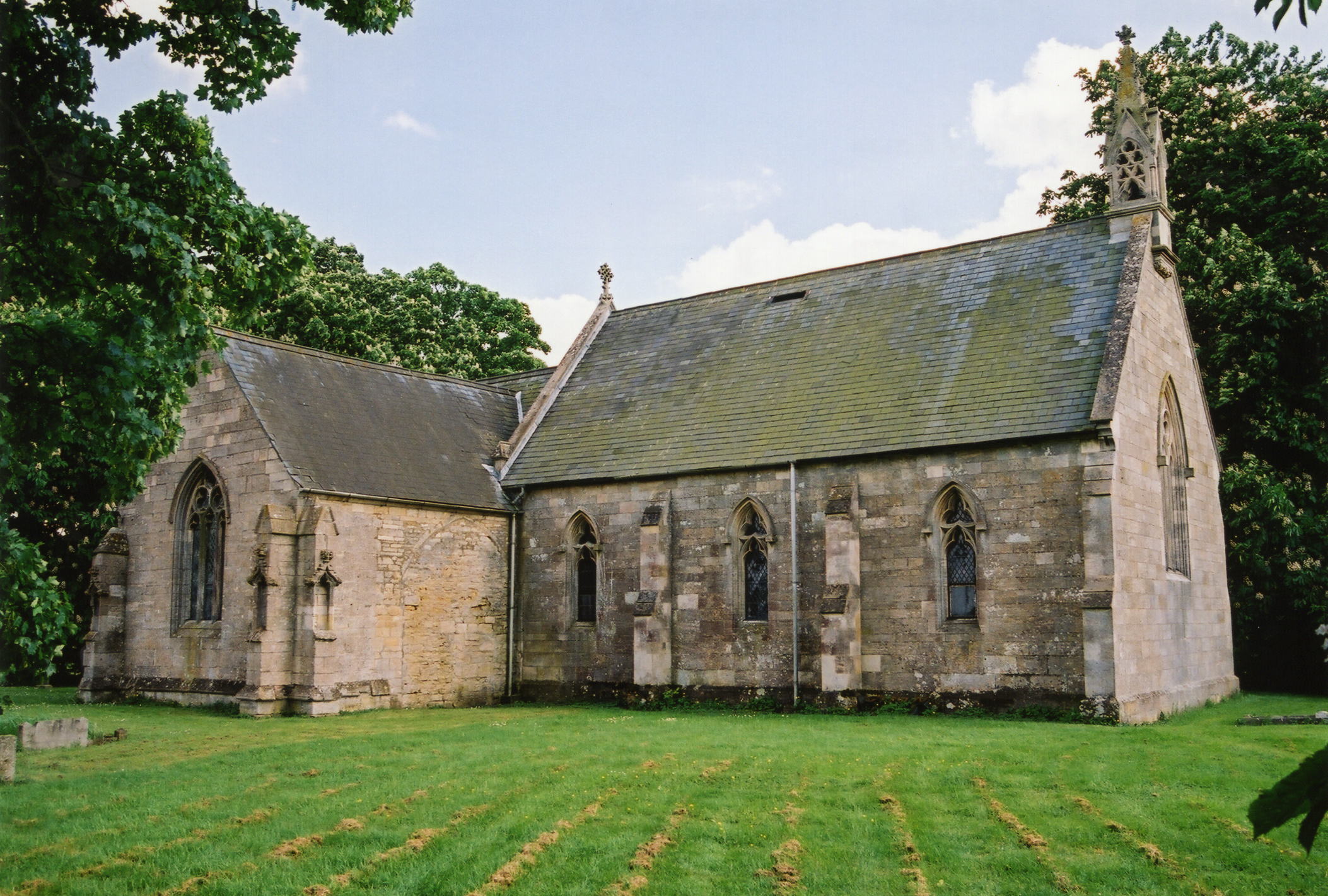
- The Anglican parish church is dedicated to Saint Andrew.
- The church was built in 1330-40 by Sir Roger PEDWARDINE.
- The old Norman tower fell down in 1802 and was replaced the next year.
- The present church was built on almost the same site in 1870-71.
- The church seats 70.
- The church is a Grade II listed building with British Heritage.
- David HITCHBORNE has a photograph of the Church of St Andrew on Geo-graph, taken in August, 2013.
- Here is a photo of the church, taken by Ron COLE (who retains the copyright):
- The Anglican parish register dates from 1765 for baptisms and burials and 1736 for marriages.
- The Lincolnshire FHS has a Loan Library service which has the parish registers on microfiche for Baptisms from 1765 to 1812 and Marriages from 1765 to 1811.
- The LFHS has published several marriage and burial indexes for the Lafford Deanery to make your search easier.
- Check our Church Records page for county-wide resources.
- The parish was in the Heckington sub-district of the Sleaford Registration District.
- Check our Civil Registration page for sources and background on Civil Registration which started in July, 1837.
Burton Pedwardine is a village and a parish just 5 miles southeast of Sleaford. Heckington parish is to the east and Scredington parish to the south. The parish covers just under 1,900 acres.
The village is little more than a hamlet. If you are planning a visit:
- The village lies about a mile and a half south of Asgarby off of the A17 trunk road.
- See our touring page for more sources.
- Ask for a calculation of the distance from Burton Pedwardine to another place.
- There is the base and shaft of a 15th century cross about two miles west of the village, between the railway line and the Roman King Street. Mareham Grange used to stand near the cross, so the road is called Mareham Lane.
- Wikipedia tells us that "A notable murder occurred in the parish in 1728, when Captain Thomas Mitchell, a Justice of the Peace, killed a bailiff named Pennystone Warden of Ewerby. The captain was committed to Lincoln Castle by two of his fellow magistrates and subsequently sentenced to death at Lincoln Assizes."
- The Sleaford Brick Co. Ltd. had works at the western edge of the Parish until 1922.
- The Pedwardine family of Herefordshire acquired this manor through marriage in 1330.
- Mareham Hall had disappeared by 1911.
- See our "Maps" page for additional resources.
You can see maps centred on OS grid reference TF119421 (Lat/Lon: 52.964598, -0.335393), Burton Pedwardine which are provided by:
- OpenStreetMap
- Google Maps
- StreetMap (Current Ordnance Survey maps)
- Bing (was Multimap)
- Old Maps Online
- National Library of Scotland (Old Ordnance Survey maps)
- Vision of Britain (Click "Historical units & statistics" for administrative areas.)
- English Jurisdictions in 1851 (Unfortunately the LDS have removed the facility to enable us to specify a starting location, you will need to search yourself on their map.)
- Magic (Geographic information) (Click + on map if it doesn't show)
- GeoHack (Links to on-line maps and location specific services.)
- All places within the same township/parish shown on an Openstreetmap map.
- Nearby townships/parishes shown on an Openstreetmap map.
- Nearby places shown on an Openstreetmap map.
For a photograph of the Buton Pedwardine War Memorial Roll in the church and the names on it, see the Roll of Honour site.
- The name Burton Pedwardine is tied to the PEDWARDINE family, ancient lords of the manor of this parish, who came here from the Fens county of Herefordshire over six centuries ago.
- The parish name is often found spelled as Burton Penwardine. But locals insist on saying the name correctly, so do not be detered by the spelling errors of others.
- The website author has no information on why the parish is sometimes called Hussey.
- This place was an ancient parish in county Lincoln and became a modern Civil Parish when those were established.
- The parish was in the ancient Aswardhurn Wapentake in the North Kesteven division of the county, in the parts of Kesteven.
- The citizens of the parish have decided to forgo a formal Parish Council, but do hold periodic Parish Meetings to vote on civic or political issues. There is NO staff to assist you with family history searches.
- For today's district governance, see the North Kesteven District Council.
- The Common Lands were enclosed here in 1802.
- The parish had a poor's land of 3 acres.
- After the Poor Law Amendment Act reforms of 1834, the parish became part of the Sleaford Poor Law Union.
- A small National School was built here in 1860 to hold 40 students. The school was enlarged in 1910.
- Terry BUTCHER has a photograph of that old school on Geo-graph, taken in 2006.
- For more on researching school records, see our Schools Research page.