
Hide
Carrington
hide
Hide
hide
Hide
hide
Hide
Hide
Hide
The Library at Boston will prove useful in your research.
- The parish was in the Sibsey sub-district of the Boston Registration District.
- Check our Census Resource page for county-wide resources.
- The table below gives census piece numbers, where known:
| Census Year | Piece No. |
|---|---|
| 1841 | H.O. 107 / 630 |
| 1851 | H.O. 107 / 2098 |
| 1861 | R.G. 9 / 2334 |
| 1871 | R.G. 10 / 3339 |
| 1891 | R.G. 12 / 2572 |
- Carrington was formed as an ecclesiastical parish with Frithville in 1886.
- The Anglican parish church is dedicated to Saint Paul.
- The chapel and cemetery were consecrated in 1816 under the "Fen Chapel Act".
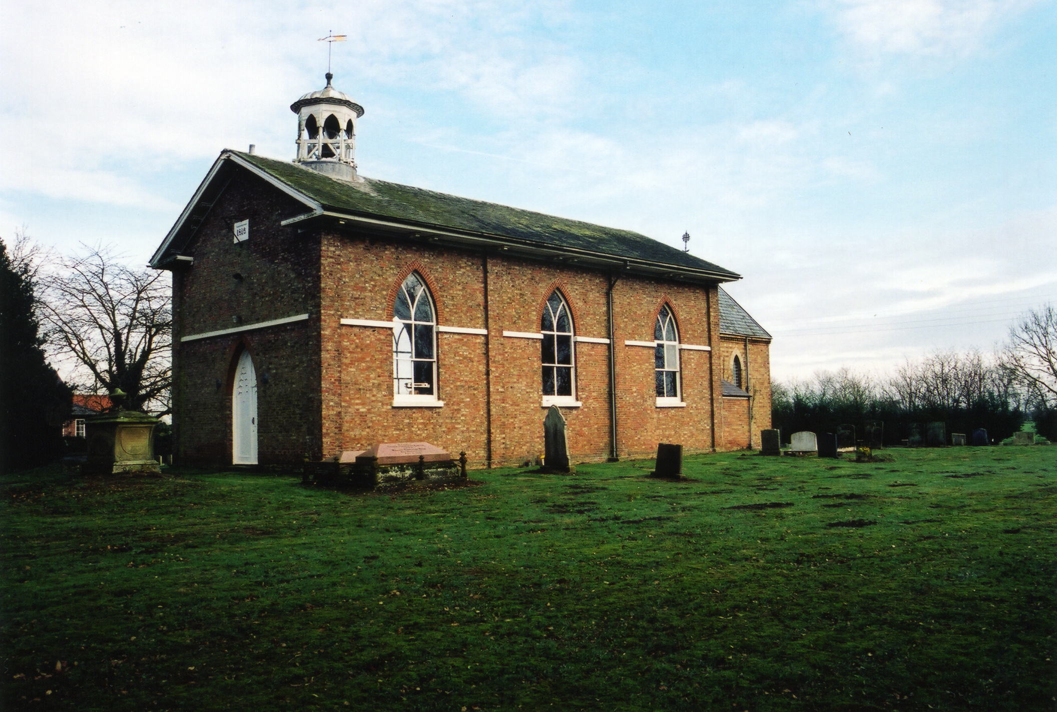
- St. Paul's was built in 1816 of brick in the late Perpendicular style.
- St. Paul's Church is a Grade II listed building with British Heritage.
- The church seats just over 200.
- Richard CROFT has a photograph of St. Paul's Church on Geo-graph, taken in November 2005.
- Here is a photo of the church, taken by (and copyright of) Norma CLARE.
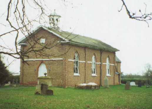
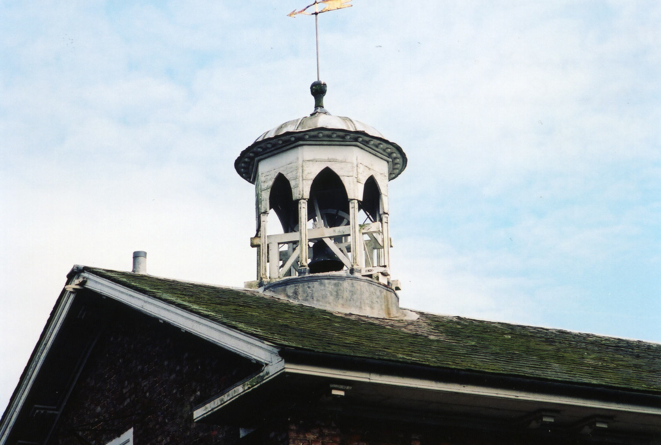
- Here are two photographs of the church, supplied by Ron COLE (who retains the copyright). The second gives a detail of the roof:
- The parish register dates from 1818, when the church was dedicated, and it includes entries for Westville hamlet.
- The Family History Library in Utah has on microfilm the register marriages for 1837-1960 and Bishop's transcripts for baptisms, marriages and burials for 1818-1859.
- As of 4th Nov 2004, the parish register above had not been deposited with the Lincolnshire Archives.
- The LFHS has published several indexes for the Holland East Deanery to make your search easier.
- Check our Church Records page for county-wide resources.
- The parish was in the Sibsey sub-district of the Boston Registration District.
- Check our Civil Registration page for sources and background on Civil Registration which began in July, 1837.
This village and parish sit in the Fenland, just 7 miles north of Boston and east of Coningsby. The parish covers about 3,575 acres and includes the village of New Bolingbroke and the hamlet of Medlam.
If you are planning a visit:
- Take the B1183 trunk road north out of Boston. Carrington village is about a mile beyond Frithville.
- See our Touring page for additional resources.
- Ask for a calculation of the distance from Carrington to another place.
- See our Maps page for additional resources.
You can see maps centred on OS grid reference TF311556 (Lat/Lon: 53.081807, -0.044203), Carrington which are provided by:
- OpenStreetMap
- Google Maps
- StreetMap (Current Ordnance Survey maps)
- Bing (was Multimap)
- Old Maps Online
- National Library of Scotland (Old Ordnance Survey maps)
- Vision of Britain (Click "Historical units & statistics" for administrative areas.)
- English Jurisdictions in 1851 (Unfortunately the LDS have removed the facility to enable us to specify a starting location, you will need to search yourself on their map.)
- Magic (Geographic information) (Click + on map if it doesn't show)
- GeoHack (Links to on-line maps and location specific services.)
- All places within the same township/parish shown on an Openstreetmap map.
- Nearby townships/parishes shown on an Openstreetmap map.
- Nearby places shown on an Openstreetmap map.
- The parish lost 7 souls in World War One.
- Kate NICOL has a photograph of the War Memorial on Geo-graph, taken in January, 2009.
The Imperial War Museum provides this list of names from the War Memorial:
- Allan, J. G. H.
- Bates, C.
- Bates, J. W.
- Beecham, A.
- Beecham, M.
- Bond, J.
- Brocklebank, V. W.
- Brummitt, F.
- Brummitt, R.
- Brummitt, Ruby
- Brummitt, R. W.
- Butler, H. H.
- Chambers, Sid
- Chambers, St
- Cope, G.
- Coultan, Maisie
- Cross, C.
- Fenston, T.
- Fielding, P. C. C.
- Gilliatt, Margaret
- Gilliatt, Percy Arthur
- Greenfield, R.
- Hall, A. W.
- Hall, I.
- Hall, I. L.
- Harness, Faith
- Harness, T.
- Haynes, W.
- Hewson, G.
- Holderness, F.
- Jackson, H.
- Leak, A.
- Maidens, F.
- Maidens, L.
- Maidens, W.
- Mann, F.
- Mann, F. W.
- Miller, G.
- Pickering, G.
- Pulford, D.
- Roberts, L. E.
- Roberts, R.
- Sharpe, H.
- Smith, Rose
- Stennett, A.
- Thompson, G. W.
- Threadgill, D. E.
- Threadgill, Joyce
- Turner, H.
- Weldon, W. H.
- Westmoreland, W.
- Whiley, F. K.
- Whiley, F. L.
- Whiley, H.
- Whiley, H.
- Woodcock, J. K.
- The village was created as a township in 1812 after drainage of the West Fen in 1802.
- The area around the village became a Civil Parish in 1858.
- The parish was in the East division of the ancient Bolingbroke Wapentake in the East Lindsey district in the parts of Lindsey.
- The parish was also in the Bolingbroke East Soke.
- For today's district governance, see the East Lindsey District Council.
- Parish boundaries were changed on 24 December, 1880, when Miningsby Fen Allotment, Asgarby Fen Allotment, a detached part of Revesby, a detached part of Bosten Fen Allotment and a detached part of Bolingbroke parish were transferred to Carrington parish.
- Bastardy cases would be heard in the Spilsby petty session hearings every other Monday.
- As a result of the 1834 Poor Law Amendment Act, this parish became part of the Boston Poor Law Union.
- The parish joined the West Fen United School district when it was formed in January of 1879. The district included Frithville parish and Westville hamlet.
- The above district board built Medlam School (properly known as Carrington County Primary School) in 1880 to hold 170 children. 1900 attendance was only 90. This school closed in 1987.
- See our Schools page for more information on researching school records.