
Hide
Chapel Hill
hide
Hide
hide
Hide
hide
Hide
Hide
Hide
- There is no local library branch. However the mobile unit does come by on alternate Mondays, generally at 9:50am for 15 minutes.
The Library at Boston will prove useful in your research.
- The parish was in the Swineshead sub-district of the Boston Registration District.
- Check our Census Resource page for county-wide resources.
- The table below gives census piece numbers, where known:
| Census Year | Piece No. |
|---|---|
| 1871 | R.G. 10 / 3346 |
| 1891 | R.G. 12 / 2576 |
- In 1826, a Chapel of Ease to Swineshead was erected for the local residents.
- In 1828, Chapel Hill went from being a Chapel of Ease as part of Swineshead ecclesiastical parish to being an ecclesiastical parish of its own.
- In 1884, the Church of Holy Trinity was erected near the site of the earlier chapel.
- The church could seat 124.
- There is a photograph of the Church of Holy Trinity on the Wendy PARKINSON web site under "Yet More Lincolnshire".
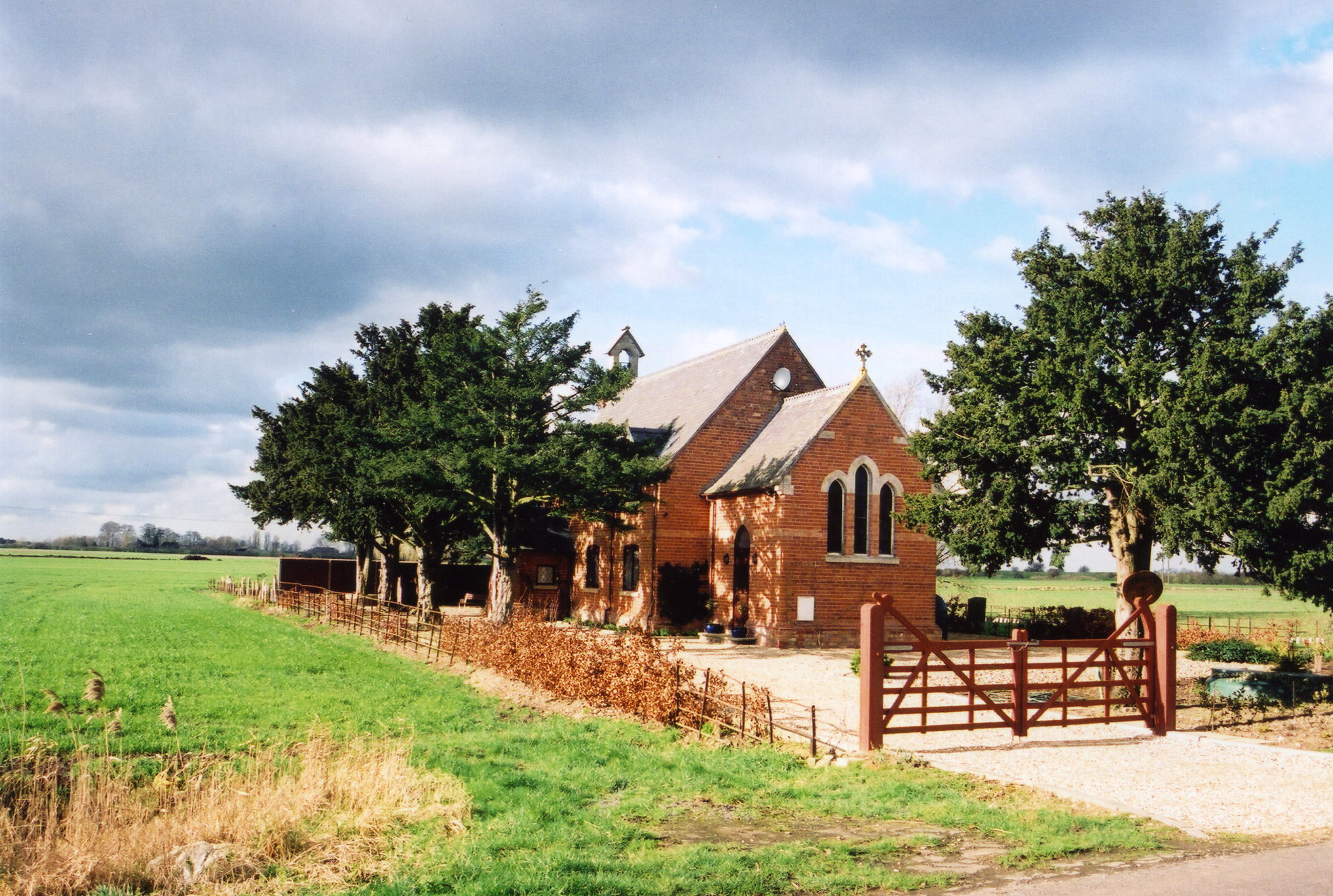
- Here is a photo of the Holy Trinity church dwelling house, taken by Ron COLE (who retains the copyright):
- The Anglican parish register dates from 1826.
- The Lincolnshire FHS has published several marriage indexes and a burial index for the Holland West Deanery to make your search easier.
- The Wesleyan Methodists and the Primitive Methodists both had chapels here. The Primitive Methodists erected their chapel in 1852.
- There is a photograph of the Methodist Chapel on the Wendy PARKINSON web site under "Yet More Lincolnshire".
- J. HANNAN-BRIGGS has a photograph of the Old Chapel Hill Methodist Church on Geo-graph, taken in August, 2011. This is now a private residence.
- For information and assistance in researching these chapels, see our non-conformist religions page.
- Check our Church Records page for county-wide resources.
- The parish was in the Swineshead sub-district of the Boston Registration District.
- Check our Civil Registration page for sources and background on Civil Registration which began in July, 1837.
Chapel Hill is a hamlet in the parish of Swineshead, which is about 11 miles to the south. The hamlet sits on the west bank of the River Witham, in the fen allotment of Swineshead parish. The hamlet is only one mile south of Dogdyke, 3 miles south of Tattershall, and 10 miles northwest of Boston.
If you are planning a visit:
- J. THOMAS has a photograph of the Village Sign on Geo-graph, taken in October, 2014.
- See our Touring page for additional resources.
- Ask for a calculation of the distance from Chapel Hill to another place.
- This parish is in the middle of an area known as "The Holland Fen." For centuries this had been a low, swampy area dotted with a few small hills. An act of Parliament in 1767 allowed for the area to be drained and developed into pastures and rich farmland. The North and South Forty Foot Drains run through the fenland and empty into the small rivers that travel east to The Wash.
- The parish is named after an ancient chapel which stood in Dogdyke township as the local chapel of ease (which later became a farm house). The River Witham formerly divided the parishes, but around 1820 the course of the river was changed. The citizens erected their own chapel of ease by subscription.
- Richard CROFT has a photograph of The Packet Inn and River Witham at Dogdyke on Geo-graph, taken in September, 2008.
- Timothy HEATON has a photograph of the Chapel Hill Bridge over Kyme Eau on geo-graph, taken in May, 2016.
- J. THOMAS has a photograph of The Crown Lodge on Geo-graph, taken in October, 2014.
- In 1900, the principal landowners were Mr. JOHNSON and Mrs. MAYFIELD.
- In 1913, the principal landowner was Mrs. MAYFIELD.
- See our Maps page for additional resources.
You can see maps centred on OS grid reference TF207543 (Lat/Lon: 53.072474, -0.1999), Chapel Hill which are provided by:
- OpenStreetMap
- Google Maps
- StreetMap (Current Ordnance Survey maps)
- Bing (was Multimap)
- Old Maps Online
- National Library of Scotland (Old Ordnance Survey maps)
- Vision of Britain (Click "Historical units & statistics" for administrative areas.)
- English Jurisdictions in 1851 (Unfortunately the LDS have removed the facility to enable us to specify a starting location, you will need to search yourself on their map.)
- Magic (Geographic information) (Click + on map if it doesn't show)
- GeoHack (Links to on-line maps and location specific services.)
- All places within the same township/parish shown on an Openstreetmap map.
- Nearby townships/parishes shown on an Openstreetmap map.
- Nearby places shown on an Openstreetmap map.
- The War Memorial is a tapering cross shaft, four-sided with chamfered corners with a square base and a three-stage plinth. It honors 8 people who fell in World War One and six ho perished in World War Two.
- Steve DRURY provides a photograph of the Chapel Hill War Memorial at WW2 Museums.
- J. HANNAN-BRIGGS also has a photograph of the War Memorial Cross on Geo-graph, taken in August, 2011.
John EMERSON provides this list of the names on the War Memorial. Information in parentheses is from the CWGC site.
1914-1918 In loyal & thankful memory of the men of this parish whose lives were given for their King & Country:
- Walter Bailey
- Richard Baxter
- Joseph Cottingham
- John Forman
- Frederick Martin
- John Martin
- George Robinson
- John Walton
Also in memory of those who lost their lives in the Second World War 1939-1945:
- Charles Edward AGUTTER (WO III, 2nd Warwick Regt.)
- John Thomas & Annie RICHARDSON (civilians, 9 Mar 1941)
- Annie RICHARDSON, (civilian, 9 Mar 1941)
- John RICHARDSON, (civilian, 9 Mar 1941)
- Thomas RICHARDSON, (civilian, 9 Mar 1941)
- The parish was in the ancient Kirton Wapentake in the Boston Borough in the parts of Holland.
- For today's borough governance, visit the local Boston Borough Council site. The home page is sometimes slow to respond.
- For today's district governance, see the North Kesteven District Council.
- Bastardy cases would be heard in the Sleaford petty session hearings.
- As a result of the Poor Law Amendment Act reforms of 1834, the parish became part of the Boston Poor Law Union.
- The children of this parish attended school in the elementary school at Tattershall Bridge, which is technically a hamlet in Dogdyke parish.
- See our Schools page for more information on researching school records.