
Hide
Dowsby
hide
Hide
hide
Hide
hide
Hide
Hide
hide
Hide
Hide
The Library at Bourne will prove useful in your research.
John BLAKESTON has a photograph of St. Andrew's Church and Churchyard on Geo-graph, taken in September, 2011.
| St Andrew, Dowsby, Church of England |
- Dowsby parish was in the Aslackby sub-district of the Bourne Registration District.
- Check our Census Resource page for county-wide resources.
- The table below gives census piece numbers, where known:
| Census Year | Piece No. |
|---|---|
| 1841 | H.O. 107 / 617 |
| 1851 | H.O. 107 / 2095 |
| 1861 | R.G. 9 / 2316 |
| 1871 | R.G. 10 / 3312 |
| 1891 | R.G. 12 / 2556 |
| St Andrew, Dowsby, Church of England |
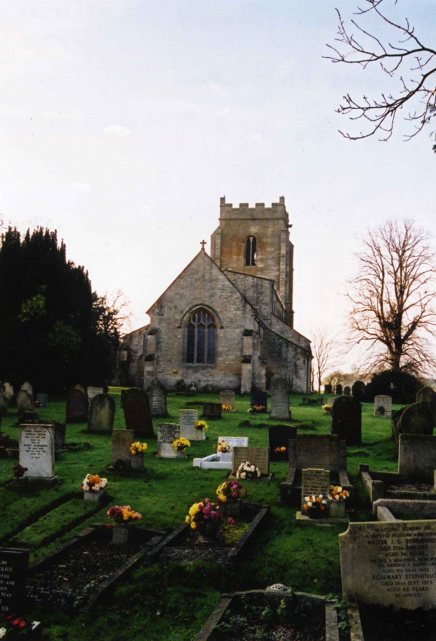
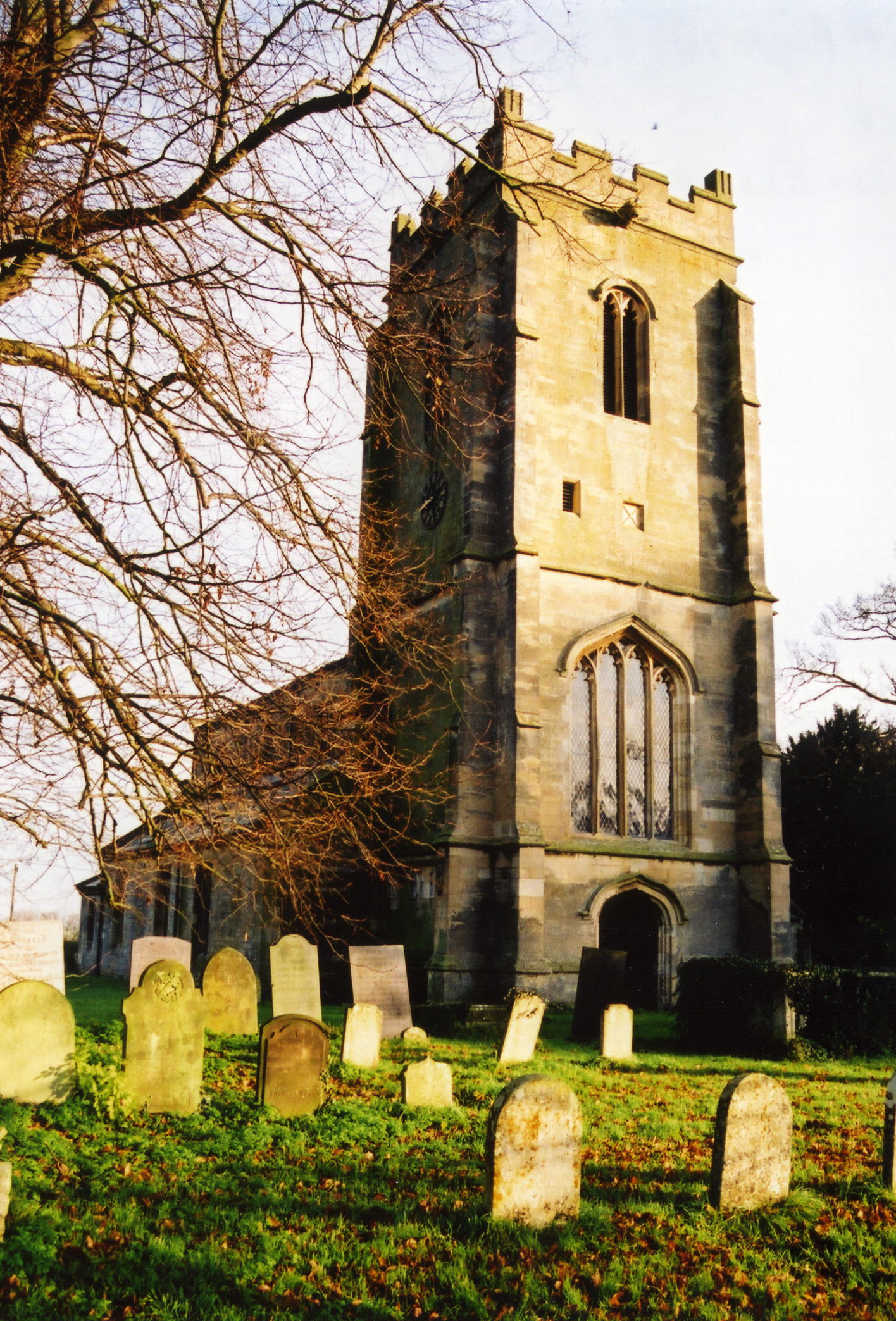
- The Anglican parish church is dedicated to Saint Andrew.
- Some portions of the building appear to be from the early Norman period, around 1400.
- The church was thoroughly restored and partially rebuilt in 1864.
- The church seats only about 140 people.
- Rex NEEDLE has a nice written profile of St. Andrew's Church.
- There is a photograph of St. Andrew's Church on the Wendy PARKINSON web site under her "Still more Lincolnshire churches".
- John BLAKESTON has a photograph of St. Andrew's Church on Geo-graph, taken in September, 2011.
- David HITCHBORNE has a good photograph of St. Andrew's Church Tower on Geo-graph, taken in August, 2013.
- Here are two photographs of St. Andrew's Church, taken by Ron COLE (who retains the copyright):
- The Anglican church parish registers exist from 1670.
- Dowsby was in the Aveland and Ness Deanery. You may wish to purchase some of the Deanery marriage indexes.
- Wikipedia tells us that the church is now in the Lafford Deanery.
- Check our Church Records page for county-wide resources.
- The parish was in the Aslackby sub-district of the Bourne Registration District.
- Check our Civil Registration page for sources and background on Civil Registration which started in July, 1837.
Dowsby is both a town and a parish six miles north of Bourne. Rippingale parish lies to the south. The South Forty Foot Drain is the eastern border. East Graby is a hamlet in this parish, near the Aslackby parish border. The parish covers about 1,820 acres.
If you are planning a visit:
- By automobile, the A15 trunk road, formerly known as the "Great Road from London to Lincoln," passes down the west side of the parish.
- There is only once-a-week bus service at last report (2011) on Kimes Busses to Bourne. See our transport page for more information.
- The nearest pub is in Aslackby.
- Marathon has a photograph of the B1397 Road headed East on Geo-graph, taken in November, 2011. Tha caption is enlightning.
- See our touring page for more sources.
- Ask for a calculation of the distance from Dowsby to another place.
- The Hoe Hills are a group of round barrows dating back to the Bronze Age. They lie just north of the village and east of Mill Lane.
- Roman and Medieval finds have been made in the parish.
- See our Maps page for additional resources.
You can see maps centred on OS grid reference TF113296 (Lat/Lon: 52.852236, -0.348473), Dowsby which are provided by:
- OpenStreetMap
- Google Maps
- StreetMap (Current Ordnance Survey maps)
- Bing (was Multimap)
- Old Maps Online
- National Library of Scotland (Old Ordnance Survey maps)
- Vision of Britain (Click "Historical units & statistics" for administrative areas.)
- English Jurisdictions in 1851 (Unfortunately the LDS have removed the facility to enable us to specify a starting location, you will need to search yourself on their map.)
- Magic (Geographic information) (Click + on map if it doesn't show)
- GeoHack (Links to on-line maps and location specific services.)
- All places within the same township/parish shown on an Openstreetmap map.
- Nearby townships/parishes shown on an Openstreetmap map.
- Nearby places shown on an Openstreetmap map.
- The clock on the church tower was added as a war memorial for World War I.
- Thre is a stone tablet in the parish church recording the names of the men who fell in World War I.
- There's a single World War II grave in the churchyard shown at Traces of War.
The Commonwealth War Grave in St. Andrew's churchyard is for:
- Alexander Arthur JOLLY, srgt., RAF Vol. Rsv., age 22, 12 Aug 1944. Son of Alexander and Clarice JOLLY of Culverthorpe.
- The name Dowsby is from the Old Scandinavian Dusi+by, for "farmstead of Dusi", appearing in the 1086 Domesday Book as Dusebi.
[A. D. Mills, "A Dictionary of English Place-Names," Oxford University Press, 1991]
- This place was an ancient parish in county Lincoln and became a modern Civil Parish when those were established.
- The parish was in the ancient Aveland Wapentake in the South Kesteven district in the parts of Kesteven.
- For today's district governance, contact the South Kesteven District Council.
- Bastardy cases were heard in the Bourne petty session hearings on Mondays.
- After the 1834 Poor Law Amendment Act reforms, the parish became part of the Bourne Poor Law Union.
- A Public Elementary School was built here in 1864 to hold up to 65 children.
- For more on researching school records, see our Schools Research page.