
Hide
East Keal
hide
Hide
hide
Hide
hide
Hide
Hide
Hide
- The parish was in the Spilsby sub-district of the Spilsby Registration District.
- Check our Census Resource page for county-wide resources.
- The table below gives census piece numbers, where known:
| Census Year | Piece No. |
|---|---|
| 1841 | H.O. 107 / 638 |
| 1851 | H.O. 107 / 2109 |
| 1861 | R.G. 9 / 2374 & 2375 |
| 1871 | R.G. 10 / 3391 & 3392 |
| 1891 | R.G. 12 / 2603 |
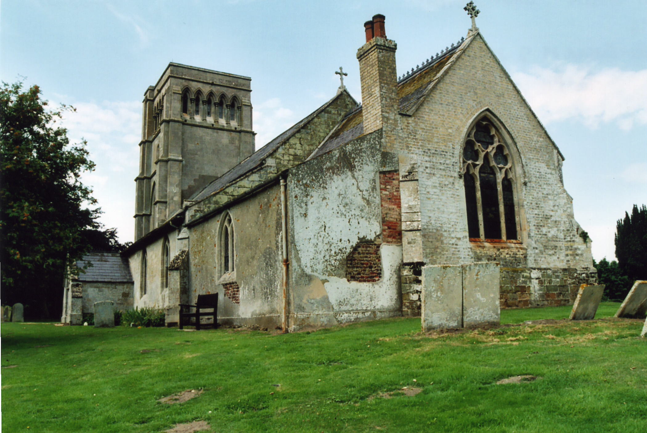
- The Anglican church is dedicated to St. Helen and dates from 1708.
- The church was restored in 1854-55.
- The church seats 250.
- There is a photograph of the Church of St. Helen on the Wendy PARKINSON Church Photos web site.
- Here is a photo of the St Helen's Church, taken by (and copyright of) Norma CLARE.

- Here are two photographs of Saint Helen's Church, taken by Ron COLE (who retains the copyright):

- The Anglican parish register dates from 1625.
- The Lincolnshire FHS has published several marriage indexes and a burial index for the Bolingbroke Deanery to make your search easier.
- There was also a chapel for Wesleyan Methodists, built in 1862. For more on researching this chapel records, see our non-conformist religions page.
- Check our Church Records page for county-wide resources.
- The parish was in the Spilsby sub-district of the Spilsby Registration District.
- Check our Civil Registration page for sources and background on Civil Registration which began in July, 1837.
East Keal is a parish southwest of Spilsby and southeast of Horncastle. West Keal parish lies to the west and Stickford to the south.
The village is often called just "Keal" and lies just 2 miles southwest of Spilsby. The hamlet of Keal Cotes lies partly in this parish. The parish covered about 1,860 acres in 1871, but increased to 1,934 acres by 1891. If you are considering a visit to the parish:
- The village stands on a rise, giving a fine view over the Fens to the south.
- By automobile, take the A16 trunk road southwest out of Spilsby. Where it meets the A155, you are in Keal.
- Check out our touring page.
- Ask for a calculation of the distance from East Keal to another place.
- There are several chalybeate springs in the parish.
- Several people have recommended the book, "East Keal, The Story of a Village", published by Marden Hill Press, Brickyard House, East Keal, Spilsby, Lincs. PE23 4HA. Price is around £9.00.
- See our Maps page for additional resources.
You can see maps centred on OS grid reference TF380638 (Lat/Lon: 53.153411, 0.062141), East Keal which are provided by:
- OpenStreetMap
- Google Maps
- StreetMap (Current Ordnance Survey maps)
- Bing (was Multimap)
- Old Maps Online
- National Library of Scotland (Old Ordnance Survey maps)
- Vision of Britain (Click "Historical units & statistics" for administrative areas.)
- English Jurisdictions in 1851 (Unfortunately the LDS have removed the facility to enable us to specify a starting location, you will need to search yourself on their map.)
- Magic (Geographic information) (Click + on map if it doesn't show)
- GeoHack (Links to on-line maps and location specific services.)
- All places within the same township/parish shown on an Openstreetmap map.
- Nearby townships/parishes shown on an Openstreetmap map.
- Nearby places shown on an Openstreetmap map.
- A Calvary cross of Clipsham stone was raised in 1920 in memory of the 14 men who died in World War 1. There is a photo of this at the Explore Lincolnshire site.
- David HITCHBORNE has a photograph of the War Memorial plaque inside the church on Geo-graph, taken in May, 2004.
- This place was an ancient parish in Lincoln county and became a modern Civil Parish when those were established.
- The parish was in the East division of the ancient Bolingbroke Wapentake in the East Lindsey district in the parts of Lindsey.
- The parish was also in the Bolingbroke Soke.
- For today's district governance, see the East Lindsey District Council.
- Bastardy cases would be heard in the Spilsby petty session hearings every other Monday.
- The Common Land was enclosed here in 1774, and 3 acres of land set aside to generate rental revenue for the poor.
- Three cottages had been set aside for the parish poor, and were sold in 1848 for £125. The money was invested and the interest used to ease the poor rates.
- In 1886 Miss RINDER left the interest on £200 for the poor.
- As a result of the 1834 Poor Law Amendment Act, the parish became part of the Spilsby Poor Law Union.
- A school was built here in 1848, but closed by 1871. It appears to have re-opened by 1900.
- See our Schools page for more information on researching school records.